Area Overview for CF35 6LZ
Photos of CF35 6LZ
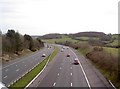


12 photos from this area
Area Information
Key information about the CF35 6LZ including its size, population, and administrative classification.
- Area Type
- Postcode
- Area Size
- 4.5 hectares
- Population
- 1876
- Population Density
- 852 people/km²
House Prices in CF35 6LZ
60
Properties
£255,856
Average Sold Price
£75,000
Lowest Price
£437,000
Highest Price
Showing 60 properties
| Address | Type | Beds | Baths | Last Sale Price | Last Sale Date | |
|---|---|---|---|---|---|---|
| 34 Duffryn Oaks Drive, Pencoed, Bridgend, CF35 6LZ | Semi-detached | 3 | 1 | £261,000 | May 2025 | |
| 59 Duffryn Oaks Drive, Pencoed, Bridgend, CF35 6LZ | Detached | 5 | 3 | £437,000 | Dec 2024 | |
| 22 Duffryn Oaks Drive, Pencoed, Bridgend, CF35 6LZ | Detached | 4 | 2 | £327,500 | Dec 2024 | |
| 38 Duffryn Oaks Drive, Pencoed, Bridgend, CF35 6LZ | Semi-detached | 3 | 2 | £240,000 | Nov 2024 | |
| 24 Duffryn Oaks Drive, Pencoed, Bridgend, CF35 6LZ | Detached | 4 | 2 | £430,000 | Oct 2024 | |
| 39 Duffryn Oaks Drive, Pencoed, Bridgend, CF35 6LZ | Detached | 4 | 3 | £204,000 | May 2024 | |
| 32 Duffryn Oaks Drive, Pencoed, Bridgend, CF35 6LZ | Detached | 4 | 3 | £330,000 | Jan 2023 | |
| 37 Duffryn Oaks Drive, Pencoed, Bridgend, CF35 6LZ | Semi-detached | 3 | 2 | £218,000 | Dec 2022 | |
| 19 Duffryn Oaks Drive, Pencoed, Bridgend, CF35 6LZ | Detached | 4 | 2 | £312,000 | Mar 2022 | |
| 3 Duffryn Oaks Drive, Pencoed, Bridgend, CF35 6LZ | house | - | - | £289,000 | Nov 2021 |
Page 1 of 6
Energy Efficiency in CF35 6LZ
Amenities
Schools
| Rank | School | Type | Entry gender | Ages |
|---|
Explore more schools in this area
Go to Schools tabDemographics
Household Size
Family (3-5 people)
most common
Accommodation Type
Houses
most common
Tenure
65
majority
Ethnic Group
White
most common
Religion
N/A
most common
Household Composition
N/A
most common
Age
47
median
Adults (30-64 years)
most common
Household Deprivation
N/A
with no deprivation
NS-SEC
28
in Lower managerial occupations
Explore more demographic insights in this area
Go to Demographics tabPlanning
Planning Constraints
- Flood RiskPremium
- Ramsar Wetland SitesPremium
- Area of Outstanding Natural BeautyPremium
- Protected Nature ReservePremium
- Protected WoodlandPremium
- Crime RiskPremium