Area Overview for CF35 5LQ
Photos of CF35 5LQ
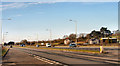
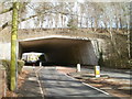
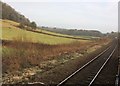
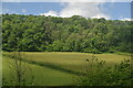
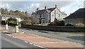
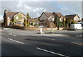
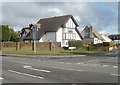
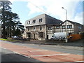

58 photos from this area
Area Information
Key information about the CF35 5LQ including its size, population, and administrative classification.
- Area Type
- Postcode
- Area Size
- 1.5 hectares
- Population
- 1586
- Population Density
- 1049 people/km²
House Prices in CF35 5LQ
27
Properties
£211,871
Average Sold Price
£74,500
Lowest Price
£450,000
Highest Price
Showing 27 properties
| Address | Type | Beds | Baths | Last Sale Price | Last Sale Date | |
|---|---|---|---|---|---|---|
| 23 Meadow Road, Pencoed, Bridgend, CF35 5LQ | house | 4 | 3 | £255,000 | Oct 2025 | |
| 11 Meadow Road, Pencoed, Bridgend, CF35 5LQ | Detached | 5 | 4 | £450,000 | May 2023 | |
| 10 Meadow Road, Pencoed, Bridgend, CF35 5LQ | house | 4 | - | £355,000 | Oct 2020 | |
| 22 Meadow Road, Pencoed, Bridgend, CF35 5LQ | Semi-detached | 4 | 3 | £160,000 | Jun 2019 | |
| 14 Meadow Road, Pencoed, Bridgend, CF35 5LQ | Detached | 4 | 3 | £345,000 | Jan 2019 | |
| 25 Meadow Road, Pencoed, Bridgend, CF35 5LQ | Terraced | 4 | 2 | £162,000 | Dec 2016 | |
| 26 Meadow Road, Pencoed, Bridgend, CF35 5LQ | Detached | 4 | 2 | £275,000 | Nov 2016 | |
| 4 Meadow Road, Pencoed, Bridgend, CF35 5LQ | Terraced | 4 | 1 | £162,500 | Jul 2016 | |
| 20 Meadow Road, Pencoed, Bridgend, CF35 5LQ | Detached | 4 | 3 | £285,000 | Dec 2015 | |
| 24 Meadow Road, Pencoed, Bridgend, CF35 5LQ | Terraced | 4 | 2 | £169,950 | Oct 2014 |
Page 1 of 3
Energy Efficiency in CF35 5LQ
Amenities
Schools
| Rank | School | Type | Entry gender | Ages |
|---|
Explore more schools in this area
Go to Schools tabDemographics
Household Size
Two person
most common
Accommodation Type
Houses
most common
Tenure
84
majority
Ethnic Group
White
most common
Religion
N/A
most common
Household Composition
N/A
most common
Age
47
median
Adults (30-64 years)
most common
Household Deprivation
N/A
with no deprivation
NS-SEC
37
in Lower managerial occupations
Explore more demographic insights in this area
Go to Demographics tabPlanning
Planning Constraints
- Flood RiskPremium
- Ramsar Wetland SitesPremium
- Area of Outstanding Natural BeautyPremium
- Protected Nature ReservePremium
- Protected WoodlandPremium
- Crime RiskPremium