Area Overview for CF35 5HD
Photos of CF35 5HD

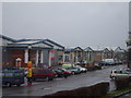


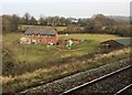
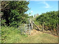
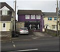
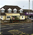
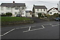
100 photos from this area
Area Information
Key information about the CF35 5HD including its size, population, and administrative classification.
- Area Type
- Postcode
- Area Size
- 2.2 hectares
- Population
- 1336
- Population Density
- 196 people/km²
House Prices in CF35 5HD
25
Properties
£199,568
Average Sold Price
£80,000
Lowest Price
£390,000
Highest Price
Showing 25 properties
| Address | Type | Beds | Baths | Last Sale Price | Last Sale Date | |
|---|---|---|---|---|---|---|
| Pentwyn Cottage, Main Road, Coychurch, Bridgend, CF35 5HD | Detached | 4 | 2 | £149,000 | Sep 2021 | |
| Court View, Main Road, Coychurch, Bridgend, CF35 5HD | Semi-detached | 4 | 2 | £260,000 | Jul 2019 | |
| Tanybryn, Main Road, Coychurch, Bridgend, CF35 5HD | Semi-detached | 4 | 2 | £275,000 | Jul 2016 | |
| Ty Cornel, Main Road, Coychurch, Bridgend, CF35 5HD | house | - | - | £169,995 | Mar 2016 | |
| Melrose, Main Road, Coychurch, Bridgend, CF35 5HD | Detached | 4 | 1 | £390,000 | Jun 2015 | |
| Glen Cottage, Main Road, Coychurch, Bridgend, CF35 5HD | Cottage | 3 | - | £130,000 | May 2014 | |
| Milton Cottage, Main Road, Coychurch, Bridgend, CF35 5HD | house | 2 | 1 | £211,000 | Jun 2010 | |
| Chestnut Cottage, The Court, Coychurch, Bridgend, CF35 5HD | Cottage | 3 | 1 | £140,000 | Apr 2009 | |
| Brynhaulog, Main Road, Coychurch, Bridgend, CF35 5HD | Detached | - | - | £245,000 | Apr 2008 | |
| Prospect House, 0 , Coychurch, Bridgend, CF35 5HD | Cottage | 3 | 4 | £240,000 | Jan 2008 |
Page 1 of 3
Energy Efficiency in CF35 5HD
Amenities
Schools
| Rank | School | Type | Entry gender | Ages |
|---|
Explore more schools in this area
Go to Schools tabDemographics
Household Size
Two person
most common
Accommodation Type
Houses
most common
Tenure
84
majority
Ethnic Group
White
most common
Religion
N/A
most common
Household Composition
N/A
most common
Age
47
median
Adults (30-64 years)
most common
Household Deprivation
N/A
with no deprivation
NS-SEC
41
in Lower managerial occupations
Explore more demographic insights in this area
Go to Demographics tabPlanning
Planning Constraints
- Flood RiskPremium
- Ramsar Wetland SitesPremium
- Area of Outstanding Natural BeautyPremium
- Protected Nature ReservePremium
- Protected WoodlandPremium
- Crime RiskPremium