Area Overview for CF33 6PP
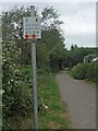
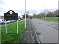
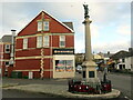
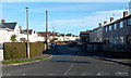
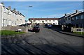
Photos of CF33 6PP


Area Information
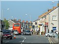
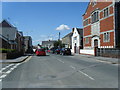
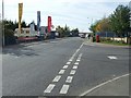
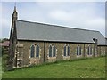
CF33 6PP is a small residential cluster in Pyle, a village in Bridgend county borough, Wales. Situated near the M4 motorway, it lies roughly equidistant between Cardiff and Swansea, offering easy access to both cities. The area has a population of 1,542, reflecting a tight-knit community with a historical connection to the region’s industrial past. Pyle itself grew after the decline of the coastal borough of Kenfig in the 15th century, with its parish church, St James’, built around 1471. The village’s proximity to Junction 37 of the M4 and the A48 road ensures strong transport links, while nearby Porthcawl offers coastal amenities. The area’s charm lies in its blend of historical architecture, such as the Grade I-listed St James’ Church, and modern convenience, with retail and rail services nearby. For those seeking a balance between rural character and urban accessibility, CF33 6PP offers a distinct identity rooted in both history and practical connectivity.
- Area Type
- Postcode
- Area Size
- Not available
- Population
- 1542
- Population Density
- 1814 people/km²
CF33 6PP is predominantly an owner-occupied area, with 64% of homes owned by residents rather than rented. The accommodation type is primarily houses, which suggests a focus on family homes and larger properties. This contrasts with areas where flats or apartments dominate, indicating a different housing dynamic. Given the small size of the postcode area, the housing stock is limited, meaning buyers may need to consider nearby suburbs for more options. The high home ownership rate implies a stable market with long-term residents, which can reduce turnover and competition. However, the concentration of houses may limit availability for those seeking smaller properties. For buyers, the area’s proximity to the M4 and rail links adds practical value, though the small size of the postcode means the immediate surroundings are critical for finding additional properties.
House Prices in CF33 6PP
No properties found in this postcode.
Energy Efficiency in CF33 6PP
Residents of CF33 6PP have access to a range of amenities within practical reach. The area includes five retail outlets, such as Asda Pyle, Tesco North, and Morrisons Daily, providing everyday shopping convenience. Rail services at Pyle, Tondu, and Sarn stations connect the area to broader networks, enhancing accessibility. Historically, the village is home to notable sites like St James’ Church, a Grade I-listed building, and the Pyle Inn, a historic coaching stop. These landmarks contribute to a sense of heritage and community character. While the data does not mention parks or leisure facilities explicitly, the proximity to Porthcawl and the M4 suggests opportunities for coastal recreation and regional travel. The blend of practical amenities and historical interest offers a lifestyle that balances convenience with cultural richness, appealing to those seeking both modern comforts and a connection to the past.
Amenities
Schools
The nearest school to CF33 6PP is Cynffig Comprehensive School, which is categorised as an "other" type in the data. No specific Ofsted rating is provided, so its performance remains unspecified. The presence of a single comprehensive school suggests that families in the area may have limited local options, though the proximity to Pyle and nearby towns could offer additional educational choices. Comprehensive schools typically cater to a broad age range, which aligns with the area’s demographic profile of middle-aged adults. However, the absence of primary schools or nurseries in the data means that younger families may need to rely on nearby settlements for early education. The lack of detailed school performance metrics means prospective buyers should investigate further to assess the quality of local education.
| Rank | School | Type | Entry gender | Ages |
|---|
Explore more schools in this area
Go to Schools tabDemographics
The population of CF33 6PP is 1,542, with a median age of 47, indicating a mature demographic skewed toward adults aged 30–64. Home ownership is high, at 64%, suggesting a stable community with long-term residents. The predominant accommodation type is houses, reflecting a preference for family homes over flats. The majority of residents identify as White, though specific diversity statistics are not provided. The age profile implies a population focused on middle-aged adults, which may influence local services and amenities. With no data on deprivation levels, it is reasonable to infer that the area’s moderate population size and home ownership rates contribute to a relatively self-sufficient community. The absence of younger demographics may affect school enrollment numbers and the demand for family-oriented facilities.
Household Size
Accommodation Type
Tenure
Ethnic Group
Religion
Household Composition
Age
Household Deprivation
NS-SEC
Explore more demographic insights in this area
Go to Demographics tabPlanning
Planning Constraints
- Flood RiskPremium
- Ramsar Wetland SitesPremium
- Area of Outstanding Natural BeautyPremium
- Protected Nature ReservePremium
- Protected WoodlandPremium
- Crime RiskPremium