Area Overview for CF33 4PH
Photos of CF33 4PH
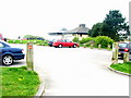
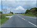
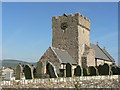

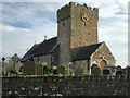
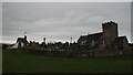
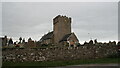
37 photos from this area
Area Information
Key information about the CF33 4PH including its size, population, and administrative classification.
- Area Type
- Postcode
- Area Size
- 7.2 hectares
- Population
- 1393
- Population Density
- 1742 people/km²
House Prices in CF33 4PH
39
Properties
£380,653
Average Sold Price
£109,000
Lowest Price
£790,000
Highest Price
Showing 39 properties
| Address | Type | Beds | Baths | Last Sale Price | Last Sale Date | |
|---|---|---|---|---|---|---|
| The Cherries, Heol Las, Mawdlam, Bridgend, CF33 4PH | Bungalow | 5 | 2 | £357,500 | Dec 2024 | |
| Bryn Glas, Heol Las, Mawdlam, Bridgend, CF33 4PH | house | - | - | £286,000 | Jul 2022 | |
| Bluebell House, Heol Las, Mawdlam, Bridgend, CF33 4PH | Detached | 4 | 3 | £630,000 | Dec 2021 | |
| The Poppies, Heol Las, Mawdlam, Bridgend, CF33 4PH | Detached | 4 | 3 | £680,000 | Jul 2021 | |
| Delfryn, Heol Las, Mawdlam, Bridgend, CF33 4PH | house | 5 | 3 | £790,000 | Aug 2020 | |
| Carreg Lwyd, Heol Las, Mawdlam, Bridgend, CF33 4PH | Detached | 4 | 3 | £520,000 | Dec 2019 | |
| Ty Llan, Heol Las, Mawdlam, Bridgend, CF33 4PH | Land | 4 | 4 | £405,000 | May 2017 | |
| 1, Fir Tree Cottages, Heol Las, Mawdlam, Bridgend, CF33 4PH | Semi-detached | 2 | 1 | £109,000 | Nov 2016 | |
| Fleetwood House, Heol Las, Mawdlam, Bridgend, CF33 4PH | Detached | 4 | - | £290,000 | Nov 2014 | |
| Omega House, Heol Las, Mawdlam, Bridgend, CF33 4PH | Detached | 3 | 2 | £250,000 | Feb 2014 |
Page 1 of 4
Energy Efficiency in CF33 4PH
Amenities
Schools
| Rank | School | Type | Entry gender | Ages |
|---|
Explore more schools in this area
Go to Schools tabDemographics
Household Size
Two person
most common
Accommodation Type
Houses
most common
Tenure
62
majority
Ethnic Group
White
most common
Religion
N/A
most common
Household Composition
N/A
most common
Age
47
median
Adults (30-64 years)
most common
Household Deprivation
N/A
with no deprivation
NS-SEC
23
in Lower managerial occupations
Explore more demographic insights in this area
Go to Demographics tabPlanning
Planning Constraints
- Flood RiskPremium
- Ramsar Wetland SitesPremium
- Area of Outstanding Natural BeautyPremium
- Protected Nature ReservePremium
- Protected WoodlandPremium
- Crime RiskPremium