Area Overview for CF33 4LD
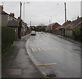
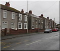
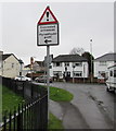
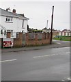
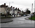
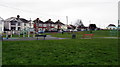
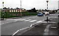
Photos of CF33 4LD

Area Information
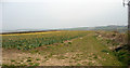
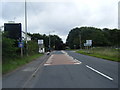
CF33 4LD lies within the Cornelly area of Bridgend County Borough, a small residential cluster near Pyle and Porthcawl in South Wales. The postcode covers 2,543 square metres, housing 1,393 people in a densely populated setting. This area is historically significant, with buried medieval ruins of Kenfig, a 12th-century walled town, hidden beneath sand dunes. Modern Cornelly was formed in 2002, splitting from Cynffig along railway lines. Daily life here balances historical intrigue with practicality, with the A48 and M4 motorways providing direct links to nearby towns. The proximity to Pyle’s urban amenities and mainline rail stations offers connectivity without sacrificing the quiet charm of a small community. Residents benefit from a tight-knit environment, where local landmarks like Sker House and the remnants of Kenfig’s past add character. The area’s compact size means most amenities are within walking or short driving distance, making it ideal for those seeking convenience without urban sprawl.
- Area Type
- Postcode
- Area Size
- 2543 m²
- Population
- 1393
- Population Density
- 1742 people/km²
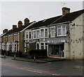
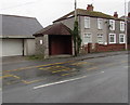
CF33 4LD is primarily an owner-occupied area, with 62% of homes owned by residents rather than rented. The accommodation type is predominantly houses, which is typical for small, rural or semi-rural postcodes. This suggests a housing stock that is likely older, with fewer high-rise or modern developments. Given the area’s small size and high population density, the property market may be limited in scope, with limited availability for buyers seeking new builds or larger homes. The focus on owner-occupation implies a stable market with fewer fluctuations, but buyers should consider the potential for a tight local market, especially for properties near key amenities like rail stations or major roads. The proximity to the M4 and A48 also positions the area as a commuter hub for nearby towns, which could influence property values and demand.
House Prices in CF33 4LD
No properties found in this postcode.
Energy Efficiency in CF33 4LD
Residents of CF33 4LD have access to a range of nearby amenities, including five retail outlets such as Tesco North, Asda Pyle, and Morrisons Daily, ensuring everyday shopping needs are met locally. The area’s proximity to Pyle’s urban core means additional services, dining, and leisure options are within reach. Rail stations like Pyle, Tondu, and Sarn provide easy access to regional transport networks, while the A48 and M4 motorways connect to major cities. The historical sites of Kenfig and Sker House add cultural depth, offering opportunities for exploration and reflection. The compact nature of the area means most amenities are within walking or short driving distance, fostering a convenient, community-focused lifestyle.
Amenities
Schools
| Rank | School | Type | Entry gender | Ages |
|---|
Explore more schools in this area
Go to Schools tabDemographics
CF33 4LD has a median age of 47, with the majority of residents aged between 30 and 64. This suggests a stable community of middle-aged and older adults, likely with established careers and family ties. Home ownership is high at 62%, indicating a preference for long-term residency over rental properties. The area is predominantly composed of houses rather than flats, reflecting a suburban or semi-rural housing stock. The predominant ethnic group is White, with no specific data on other demographics provided. The population density of 547,819 people per square kilometre is exceptionally high for a small postcode, implying a compact, closely knit community. This density, combined with the age profile, suggests a mature population with fewer young families, which may influence local services and amenities.
Household Size
Accommodation Type
Tenure
Ethnic Group
Religion
Household Composition
Age
Household Deprivation
NS-SEC
Explore more demographic insights in this area
Go to Demographics tabPlanning
Planning Constraints
- Flood RiskPremium
- Ramsar Wetland SitesPremium
- Area of Outstanding Natural BeautyPremium
- Protected Nature ReservePremium
- Protected WoodlandPremium
- Crime RiskPremium