Area Overview for CF32 9XP
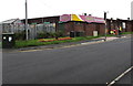
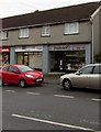
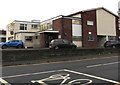
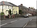
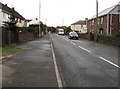
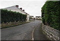
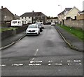
Photos of CF32 9XP
Area Information
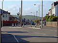
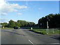
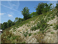
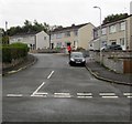
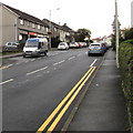
CF32 9XP lies within St Bride’s Minor, a quiet community in Bridgend County Borough, Wales. This postcode area covers a small residential cluster, blending housing estates with rural elements. The population of 1,198 reflects a tight-knit, low-density settlement, with Sarn housing estate forming a core part of the area. To the north, the M4 motorway marks a boundary, while farmland stretches eastward, punctuated by scattered farmhouses. Historically linked to Bridgend’s market town, the area benefits from proximity to its economic and cultural hub. The McArthurGlen Designer Outlet, though beyond the M4, is accessible, offering retail opportunities. Daily life here is shaped by a mix of suburban convenience and rural tranquillity, with local amenities like Sarn Railway Station providing transport links to Bridgend and beyond. The community’s character is defined by its modest scale, making it ideal for those seeking a peaceful yet connected lifestyle without the pressures of larger towns.
- Area Type
- Postcode
- Area Size
- Not available
- Population
- 1198
- Population Density
- 3125 people/km²
The property market in CF32 9XP is characterised by a 57% home ownership rate, with houses forming the majority of accommodation. This suggests a mix of owner-occupied properties and rental units, though the small population of 1,198 implies limited housing stock. The presence of Sarn housing estate indicates a focus on suburban, family-friendly homes, likely with gardens and single-storey designs. Buyers should note that the area’s size restricts property diversity, with few detached or luxury options. Proximity to Bridgend and the M4 motorway may make it attractive for commuters, but the small scale means limited scope for investment or development. Those seeking a quiet, low-density home with access to nearby amenities may find this area appealing, though the market remains niche.
House Prices in CF32 9XP
No properties found in this postcode.
Energy Efficiency in CF32 9XP
Living in CF32 9XP offers access to essential amenities within practical reach. Retail options include M&S Bridgend, Sainsburys Bridgend, and Farmfoods Tondu, all within a short drive or walk, supporting daily shopping needs. The rail network is a key feature, with Sarn, Tondu, and Wildmill stations providing links to Bridgend and regional hubs. While the area itself has few parks or leisure facilities, its proximity to Bridgend ensures access to broader cultural and recreational offerings. The McArthurGlen Designer Outlet, though beyond the M4, adds retail variety. The mix of housing estates and farmland creates a semi-rural feel, balancing convenience with tranquillity. For residents, the lifestyle combines suburban practicality with the ease of nearby town amenities, though the area’s small scale means limited local entertainment or dining options.
Amenities
Schools
| Rank | School | Type | Entry gender | Ages |
|---|
Explore more schools in this area
Go to Schools tabDemographics
The population of CF32 9XP is 1,198, with a median age of 47, indicating a mature demographic. The most common age range is adults aged 30–64, suggesting a stable, working-age population. Home ownership stands at 57%, with houses being the predominant accommodation type. This reflects a community where family homes are common, though rental options likely exist given the ownership rate. The predominant ethnic group is White, aligning with broader Welsh demographics. While no deprivation data is provided, the age profile and housing stock suggest a relatively stable area, though the lack of younger residents may impact local services and schools. The absence of specific diversity metrics means the community’s social makeup remains largely unquantified in the data.
Household Size
Accommodation Type
Tenure
Ethnic Group
Religion
Household Composition
Age
Household Deprivation
NS-SEC
Explore more demographic insights in this area
Go to Demographics tabPlanning
Planning Constraints
- Flood RiskPremium
- Ramsar Wetland SitesPremium
- Area of Outstanding Natural BeautyPremium
- Protected Nature ReservePremium
- Protected WoodlandPremium
- Crime RiskPremium