Area Overview for CF32 7LD
Photos of CF32 7LD
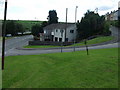

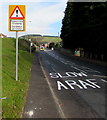
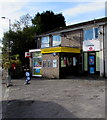
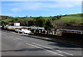
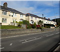
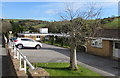
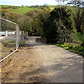
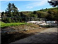

29 photos from this area
Area Information
Key information about the CF32 7LD including its size, population, and administrative classification.
- Area Type
- Postcode
- Area Size
- 9171 m²
- Population
- 1420
- Population Density
- 223 people/km²
House Prices in CF32 7LD
20
Properties
£102,438
Average Sold Price
£22,000
Lowest Price
£168,000
Highest Price
Showing 20 properties
| Address | Type | Beds | Baths | Last Sale Price | Last Sale Date | |
|---|---|---|---|---|---|---|
| 12 Heol Aelfryn, Pant Yr Awel, Ogmore Vale, CF32 7LD | Semi-detached | 3 | 1 | £156,500 | Jun 2022 | |
| 16 Heol Aelfryn, Pant Yr Awel, Ogmore Vale, CF32 7LD | house | - | - | £168,000 | Oct 2021 | |
| 4 Heol Aelfryn, Pant Yr Awel, Ogmore Vale, CF32 7LD | house | - | - | £95,000 | Dec 2019 | |
| 3 Heol Aelfryn, Pant Yr Awel, Ogmore Vale, CF32 7LD | Semi-detached | 3 | 2 | £140,000 | Nov 2019 | |
| 10 Heol Aelfryn, Pant Yr Awel, Ogmore Vale, CF32 7LD | Semi-detached | 3 | 1 | £85,000 | Sep 2018 | |
| 19 Heol Aelfryn, Pant Yr Awel, Ogmore Vale, CF32 7LD | house | - | - | £75,000 | Oct 2015 | |
| 8 Heol Aelfryn, Pant Yr Awel, Ogmore Vale, CF32 7LD | house | - | - | £78,000 | Jan 2013 | |
| 11 Heol Aelfryn, Pant Yr Awel, Ogmore Vale, CF32 7LD | Semi-detached | - | - | £22,000 | Jun 1997 | |
| 13 Heol Aelfryn, Pant Yr Awel, Ogmore Vale, CF32 7LD | Semi-detached | 3 | - | - | - | |
| 2 Heol Aelfryn, Pant Yr Awel, Ogmore Vale, CF32 7LD | house | 3 | - | - | - |
Page 1 of 2
Energy Efficiency in CF32 7LD
Amenities
Schools
| Rank | School | Type | Entry gender | Ages |
|---|
Explore more schools in this area
Go to Schools tabDemographics
Household Size
Two person
most common
Accommodation Type
Houses
most common
Tenure
61
majority
Ethnic Group
White
most common
Religion
N/A
most common
Household Composition
N/A
most common
Age
47
median
Adults (30-64 years)
most common
Household Deprivation
N/A
with no deprivation
NS-SEC
23
in Lower managerial occupations
Explore more demographic insights in this area
Go to Demographics tabPlanning
Planning Constraints
- Flood RiskPremium
- Ramsar Wetland SitesPremium
- Area of Outstanding Natural BeautyPremium
- Protected Nature ReservePremium
- Protected WoodlandPremium
- Crime RiskPremium