Area Overview for CF32 7HS
Photos of CF32 7HS


Area Information
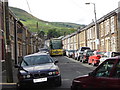
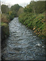
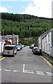
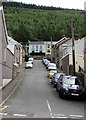
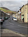
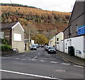
Living in CF32 7HS places you in a specific residential cluster within the broader Ogmore Valley community in Bridgend County Borough, Wales. This postcode covers an area of 1443 m² serving a population of 1755 residents. The demographic profile shows a mature community where adults aged 30 to 64 years form the most common age range, with a median age of 47 years. Your daily life centre on a settled neighbourhood characterised by a high level of stability and long-term residency. The history of this valley dates back to the mid-19th century when the Ogmore Valley Railway opened in 1865, transforming it from a rural farming area into a populated mining community. While the area has transitioned from its industrial past, it retains a quiet residential calm compared to modern urban developments. The local character is defined by the basins of the Ogwr Fawr and Ogwr Fach rivers, running through villages like Ogmore Vale and Nantymoel. You are part of a fabric where civic development has always been a priority, with pioneers in the 19th century building schools and community infrastructure. This legacy continues to shape the environment you inhabit, offering a sense of place rooted in practical history rather than tourist appeal. The area functions as a self-contained residential unit where the rhythm of life depends on local amenities and reliable transport links rather than high-speed commuter convenience.
- Area Type
- Postcode
- Area Size
- 1443 m²
- Population
- 1755
- Population Density
- 192 people/km²
The property market in CF32 7HS operates predominantly as an owner-occupied sector. With 77% of residents owning their homes, sales activity typically involves establishing families or couples seeking permanent residence. The accommodation stock consists almost entirely of houses, reflecting the rural valley origins of the classification. You are buying properties designed as standalone dwellings rather than urban flats or high-density blocks. The small size of the residential cluster implies a limited but distinct pool of choices within the 1443 m² footprint. This scarcity often maintains property values for those who fit the demographic profile of the 30 to 64 age group. The history of the area as a former coal mining community influences the types of terracotta-built homes available, though specific architectural details are not detailed in your data. Buyers look at this postcode for its quiet character and separation from the immediate hustle of Bridgend town. The market dynamics suggest that when you enter the fray, competition is likely to come from buyers seeking established ownership rather than investors targeting rental yields. You are purchasing a stake in a heritage-rich environment where the transition from agricultural land to industrial town has already occurred. Your purchasing power will test against the supply of houses that have weathered decades of valley life. The consistency of ownership suggests that property here is viewed as a lifetime asset rather than a temporary stopover.
House Prices in CF32 7HS
Showing 5 properties
| Address | Type | Beds | Baths | Last Sale Price | Last Sale Date | |
|---|---|---|---|---|---|---|
| 2, Alma Terrace, Cemetery Road, Ogmore Vale, CF32 7HS | Cottage | 2 | 1 | £75,000 | Apr 2025 | |
| 1, Alma Terrace, Cemetery Road, Ogmore Vale, CF32 7HS | Retail | 2 | 1 | £78,000 | Dec 2022 | |
| 4, Alma Terrace, Cemetery Road, Ogmore Vale, CF32 7HS | house | - | - | £62,500 | May 2006 | |
| 3, Alma Terrace, Cemetery Road, Ogmore Vale, CF32 7HS | house | 2 | - | £47,500 | May 2005 | |
| 5, Alma Terrace, Cemetery Road, Ogmore Vale, CF32 7HS | Terraced | - | - | - | - |
Energy Efficiency in CF32 7HS
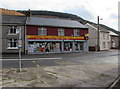
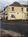
Residents of CF32 7HS enjoy a range of retail and rail amenities within practical reach. Five significant retailers operate nearby, headed by Co-op Pontycymmer, Co-op Garden, and Spar. These outlets provide essential groceries and daily necessities without requiring a lengthy journey into Bridgend town. Three railway stations are located within the immediate vicinity, including Tondu Railway Station, Garth Railway Station, and Tonypandy Railway Station. These stations offer regular links to the wider network, allowing easy commutes to the Cardiff and Bristol InterCity services. Your lifestyle revolves around this convenient access to food and transport hubs. The community feels self-sufficient because these amenities sit close enough to integrate into a daily routine. You can walk to the Co-op stores or catch a train from the nearby stations without feeling isolated. The history of the Ogmore Valley Railway once drove the economy through coal transport, and the modern rail links continue to connect this residential patch to the outside world. Dining options and leisure facilities are not explicitly detailed in the current dataset, so your evening choices likely depend on the specific capacity of the local stores. The presence of these specific venues defines the character of the neighbourhood. Living here means you balance the quiet of a valley with the practicality of urban services, all within a short radius.
Amenities
Schools
Three specific educational institutions serve the needs of children living near CF32 7HS. Ogmore Vale Nursery School operates within the cluster, providing early years education and childcare. Aber Infants School covers the primary phase for younger students, feeding into Tynewydd Junior School for older children. All three are classified under the 'other' type in the available data, indicating they function as standalone institutions without specified national curriculum designations in this dataset. This mix ensures a complete educational path is available without needing immediate travel to larger towns. The proximity of these facilities means you can access convenience for your children's development while remaining rooted in the community. Families in the 30 to 64 age range benefit from having these options within practical reach. You do not face the pressure of transferring children to distant academies or specialized facilities located in separate postcode districts. The presence of a nursery alongside infant and junior schools suggests a cohesive local system designed to support local families. This arrangement simplifies daily logistics for parents working in the wider Bridgend County Borough area. The schools form the backbone of family life in the postcode, acting as central points for community engagement and child development. Their location supports the residential nature of the area, ensuring schools remain integrated into the daily rhythm of neighbourhood life.
| Rank | School | Type | Entry gender | Ages |
|---|
Explore more schools in this area
Go to Schools tabDemographics
The community in CF32 7HS is defined by distinct demographic markers that reflect a stable, established neighbourhood. Seventy-seven per cent of households own their homes, indicating strong roots in the locality. Accommodation is primarily composed of houses rather than flats or apartments. The population skew towards adults aged 30 to 64 years means your neighbours are likely to be in the middle stages of their lives, valuing stability. White residents form the predominant ethnic group in the area. This age profile suggests families with established careers or retirees enjoying a settled lifestyle away from the fastest-growing high-density pockets of Wales. The lower population density of 192 people per km² ensures you are not forced into high-rise living or crowded streets. Instead, you experience a spread of housing across a defined geographical footprint. This spread supports a lower intensity of daily life without sacrificing access to essential services. The high home ownership rate of 77% means property transactions occur more frequently among existing residents selling to other families or individuals looking for similar character homes. You are buying into a market driven by long-term commitment rather than short-term rental turnover. The demographic data paints a picture of a neighbourhood where generations have built careers and lives, creating default patterns of behaviour and community interaction that prioritise quiet and residence.
Household Size
Accommodation Type
Tenure
Ethnic Group
Religion
Household Composition
Age
Household Deprivation
NS-SEC
Explore more demographic insights in this area
Go to Demographics tabPlanning
Planning Constraints
- Flood RiskPremium
- Ramsar Wetland SitesPremium
- Area of Outstanding Natural BeautyPremium
- Protected Nature ReservePremium
- Protected WoodlandPremium
- Crime RiskPremium