Area Overview for CF32 7BA
Photos of CF32 7BA
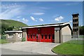
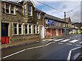
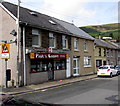
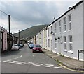
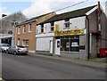
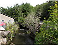
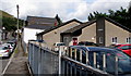
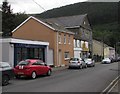
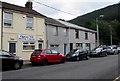
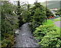
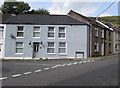
100 photos from this area
Area Information
Key information about the CF32 7BA including its size, population, and administrative classification.
- Area Type
- Postcode
- Area Size
- 2.2 hectares
- Population
- 1755
- Population Density
- 192 people/km²
House Prices in CF32 7BA
69
Properties
£83,934
Average Sold Price
£23,000
Lowest Price
£160,000
Highest Price
Showing 69 properties
| Address | Type | Beds | Baths | Last Sale Price | Last Sale Date | |
|---|---|---|---|---|---|---|
| 65 St John Street, Ogmore Vale, CF32 7BA | Terraced | 2 | 2 | £105,000 | Oct 2025 | |
| 39 St John Street, Ogmore Vale, CF32 7BA | house | 3 | - | £150,000 | Feb 2025 | |
| 18 St John Street, Ogmore Vale, CF32 7BA | Terraced | 3 | 1 | £141,000 | Apr 2023 | |
| 59 St John Street, Ogmore Vale, CF32 7BA | Terraced | 3 | 1 | £160,000 | Feb 2023 | |
| 44 St. John Street, Ogmore Vale, Bridgend, CF32 7BA | Terraced | 3 | 1 | £130,000 | May 2022 | |
| 28 St John Street, Ogmore Vale, CF32 7BA | house | 3 | 1 | £153,000 | Feb 2022 | |
| 48 St John Street, Ogmore Vale, CF32 7BA | Terraced | 2 | 1 | £91,000 | Sep 2020 | |
| 43 St John Street, Ogmore Vale, CF32 7BA | Terraced | 2 | 1 | £80,000 | Mar 2020 | |
| 47 St John Street, Ogmore Vale, CF32 7BA | Terraced | 3 | 1 | £94,950 | Jan 2020 | |
| 26 St John Street, Ogmore Vale, CF32 7BA | Terraced | 3 | 1 | £63,000 | Nov 2019 |
Page 1 of 7
Energy Efficiency in CF32 7BA
Amenities
Schools
| Rank | School | Type | Entry gender | Ages |
|---|
Explore more schools in this area
Go to Schools tabDemographics
Household Size
Family (3-5 people)
most common
Accommodation Type
Houses
most common
Tenure
77
majority
Ethnic Group
White
most common
Religion
N/A
most common
Household Composition
N/A
most common
Age
47
median
Adults (30-64 years)
most common
Household Deprivation
N/A
with no deprivation
NS-SEC
24
in Lower managerial occupations
Explore more demographic insights in this area
Go to Demographics tabPlanning
Planning Constraints
- Flood RiskPremium
- Ramsar Wetland SitesPremium
- Area of Outstanding Natural BeautyPremium
- Protected Nature ReservePremium
- Protected WoodlandPremium
- Crime RiskPremium