Area Overview for CF32 0HE
Photos of CF32 0HE
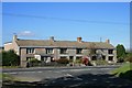
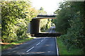
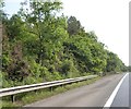
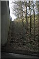

11 photos from this area
Area Information
Key information about the CF32 0HE including its size, population, and administrative classification.
- Area Type
- Postcode
- Area Size
- 1.1 km²
- Population
- 2302
- Population Density
- 711 people/km²
House Prices in CF32 0HE
13
Properties
£474,500
Average Sold Price
£323,500
Lowest Price
£650,000
Highest Price
Showing 13 properties
| Address | Type | Beds | Baths | Last Sale Price | Last Sale Date | |
|---|---|---|---|---|---|---|
| Llangewydd Cottage, Pant Rhosla, Court Colman, Bridgend, CF32 0HE | Detached | 1 | 1 | £650,000 | Jul 2023 | |
| The Hollies, Pant Rhosla, Court Colman, Bridgend, CF32 0HE | Detached | 3 | 2 | £323,500 | Mar 2017 | |
| Lluest Fach, Pant Rhosla, Court Colman, Bridgend, CF32 0HE | house | - | - | £450,000 | Dec 2009 | |
| Swyn-y-deryn, Pant Rhosla, Court Colman, Bridgend, CF32 0HE | Detached | 2 | 2 | - | - | |
| Ty George, Pant Rhosla, Court Colman, Bridgend, CF32 0HE | Farm | 4 | - | - | - | |
| Pantrosla Fach, Pant Rhosla, Court Colman, Bridgend, CF32 0HE | house | - | - | - | - | |
| Ffynnon Pantrhosla, Pant Rhosla, Court Colman, Bridgend, CF32 0HE | Detached | - | - | - | - | |
| Pantrosla House, Pant Rhosla, Court Colman, Bridgend, CF32 0HE | Detached | - | - | - | - | |
| The Coach House, Pant Rhosla, Court Colman, Bridgend, CF32 0HE | Flat | - | - | - | - | |
| Ballarat, Pant Rhosla, Court Colman, Bridgend, CF32 0HE | Detached | - | - | - | - |
Page 1 of 2
Energy Efficiency in CF32 0HE
Amenities
Schools
| Rank | School | Type | Entry gender | Ages |
|---|
Explore more schools in this area
Go to Schools tabDemographics
Household Size
Two person
most common
Accommodation Type
Houses
most common
Tenure
91
majority
Ethnic Group
White
most common
Religion
N/A
most common
Household Composition
N/A
most common
Age
47
median
Adults (30-64 years)
most common
Household Deprivation
N/A
with no deprivation
NS-SEC
45
in Lower managerial occupations
Explore more demographic insights in this area
Go to Demographics tabPlanning
Planning Constraints
- Flood RiskPremium
- Ramsar Wetland SitesPremium
- Area of Outstanding Natural BeautyPremium
- Protected Nature ReservePremium
- Protected WoodlandPremium
- Crime RiskPremium