Area Overview for CF31 5DD
Photos of CF31 5DD


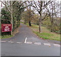
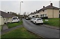
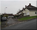
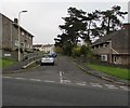
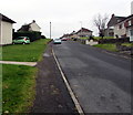
55 photos from this area
Area Information
Key information about the CF31 5DD including its size, population, and administrative classification.
- Area Type
- Postcode
- Area Size
- 9218 m²
- Population
- 1209
- Population Density
- 3904 people/km²
House Prices in CF31 5DD
23
Properties
£171,993
Average Sold Price
£86,950
Lowest Price
£358,000
Highest Price
Showing 23 properties
| Address | Type | Beds | Baths | Last Sale Price | Last Sale Date | |
|---|---|---|---|---|---|---|
| 21 Maes Y Crug, Broadlands, Bridgend, CF31 5DD | Detached | 3 | 2 | £272,500 | May 2025 | |
| 16 Maes Y Crug, Broadlands, Bridgend, CF31 5DD | Detached | 4 | 2 | £358,000 | Mar 2025 | |
| 4 Maes Y Crug, Broadlands, Bridgend, CF31 5DD | house | 3 | - | £291,500 | Dec 2021 | |
| 14 Maes Y Crug, Broadlands, Bridgend, CF31 5DD | house | 4 | - | £229,000 | Mar 2021 | |
| 19 Maes Y Crug, Broadlands, Bridgend, CF31 5DD | Detached | 3 | 2 | £197,000 | Mar 2019 | |
| 23 Maes Y Crug, Broadlands, Bridgend, CF31 5DD | Detached | 4 | - | £210,000 | Mar 2018 | |
| 20 Maes Y Crug, Broadlands, Bridgend, CF31 5DD | Detached | 4 | 1 | £190,000 | Oct 2014 | |
| 2 Maes Y Crug, Broadlands, Bridgend, CF31 5DD | Detached | 5 | 1 | £225,000 | Nov 2013 | |
| 1 Maes Y Crug, Broadlands, Bridgend, CF31 5DD | Detached | 4 | - | £168,000 | Apr 2013 | |
| 10 Maes Y Crug, Broadlands, Bridgend, CF31 5DD | Detached | - | - | £184,950 | Mar 2009 |
Page 1 of 3
Energy Efficiency in CF31 5DD
Amenities
Schools
| Rank | School | Type | Entry gender | Ages |
|---|
Explore more schools in this area
Go to Schools tabDemographics
Household Size
Family (3-5 people)
most common
Accommodation Type
Houses
most common
Tenure
83
majority
Ethnic Group
White
most common
Religion
N/A
most common
Household Composition
N/A
most common
Age
47
median
Adults (30-64 years)
most common
Household Deprivation
N/A
with no deprivation
NS-SEC
45
in Lower managerial occupations
Explore more demographic insights in this area
Go to Demographics tabPlanning
Planning Constraints
- Flood RiskPremium
- Ramsar Wetland SitesPremium
- Area of Outstanding Natural BeautyPremium
- Protected Nature ReservePremium
- Protected WoodlandPremium
- Crime RiskPremium