Area Overview for CF31 5BT
Photos of CF31 5BT

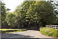
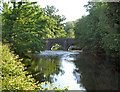
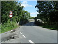
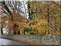


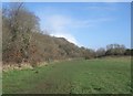
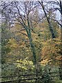


57 photos from this area
Area Information
Key information about the CF31 5BT including its size, population, and administrative classification.
- Area Type
- Postcode
- Area Size
- 4.2 hectares
- Population
- 1209
- Population Density
- 3904 people/km²
House Prices in CF31 5BT
38
Properties
£286,229
Average Sold Price
£151,960
Lowest Price
£630,000
Highest Price
Showing 38 properties
| Address | Type | Beds | Baths | Last Sale Price | Last Sale Date | |
|---|---|---|---|---|---|---|
| 14 Thornbush Hill, Broadlands, Bridgend, CF31 5BT | Terraced | 3 | 3 | £275,000 | Nov 2025 | |
| 32 Thornbush Hill, Broadlands, Bridgend, CF31 5BT | Semi-detached | 4 | 2 | £280,000 | Nov 2025 | |
| 28 Thornbush Hill, Broadlands, Bridgend, CF31 5BT | Terraced | 3 | 2 | £205,000 | Apr 2024 | |
| 7 Thornbush Hill, Broadlands, Bridgend, CF31 5BT | Detached | 6 | 3 | £395,000 | Feb 2024 | |
| 24 Thornbush Hill, Broadlands, Bridgend, CF31 5BT | Detached | 5 | 3 | £377,500 | Dec 2023 | |
| The Rowan, Thornbush Hill, Broadlands, Bridgend, CF31 5BT | Detached | 6 | 4 | £630,000 | Oct 2023 | |
| 29 Thornbush Hill, Broadlands, Bridgend, CF31 5BT | Semi-detached | 3 | 2 | £219,950 | Feb 2022 | |
| Woods Edge, Thornbush Hill, Broadlands, Bridgend, CF31 5BT | Detached | 6 | - | £520,559 | May 2021 | |
| 10 Thornbush Hill, Broadlands, Bridgend, CF31 5BT | house | - | - | £305,000 | Dec 2020 | |
| 25 Thornbush Hill, Broadlands, Bridgend, CF31 5BT | Detached | 5 | 1 | £342,000 | Dec 2020 |
Page 1 of 4
Energy Efficiency in CF31 5BT
Amenities
Schools
| Rank | School | Type | Entry gender | Ages |
|---|
Explore more schools in this area
Go to Schools tabDemographics
Household Size
Family (3-5 people)
most common
Accommodation Type
Houses
most common
Tenure
83
majority
Ethnic Group
White
most common
Religion
N/A
most common
Household Composition
N/A
most common
Age
47
median
Adults (30-64 years)
most common
Household Deprivation
N/A
with no deprivation
NS-SEC
45
in Lower managerial occupations
Explore more demographic insights in this area
Go to Demographics tabPlanning
Planning Constraints
- Flood RiskPremium
- Ramsar Wetland SitesPremium
- Area of Outstanding Natural BeautyPremium
- Protected Nature ReservePremium
- Protected WoodlandPremium
- Crime RiskPremium