Area Overview for CF31 4JX
Photos of CF31 4JX
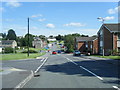
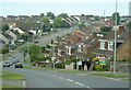

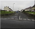
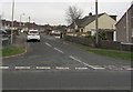
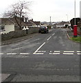
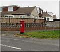
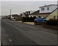
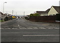
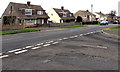

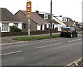
83 photos from this area
Area Information
Key information about the CF31 4JX including its size, population, and administrative classification.
- Area Type
- Postcode
- Area Size
- 1.4 hectares
- Population
- 1275
- Population Density
- 5326 people/km²
House Prices in CF31 4JX
49
Properties
£107,514
Average Sold Price
£37,000
Lowest Price
£232,000
Highest Price
Showing 49 properties
| Address | Type | Beds | Baths | Last Sale Price | Last Sale Date | |
|---|---|---|---|---|---|---|
| 110 Llangewydd Road, Bryntirion, Bridgend, CF31 4JX | Semi-detached | 2 | 1 | £168,000 | Jul 2025 | |
| 70 Llangewydd Road, Bryntirion, Bridgend, CF31 4JX | Semi-detached | 2 | 1 | £156,000 | Jul 2024 | |
| 134 Llangewydd Road, Bryntirion, Bridgend, CF31 4JX | Semi-detached | 2 | 1 | £162,000 | Jun 2024 | |
| 94 Llangewydd Road, Bryntirion, Bridgend, CF31 4JX | Semi-detached | 2 | 1 | £160,000 | May 2023 | |
| 136 Llangewydd Road, Bryntirion, Bridgend, CF31 4JX | Semi-detached | 4 | 2 | £232,000 | Aug 2022 | |
| 128 Llangewydd Road, Bryntirion, Bridgend, CF31 4JX | Semi-detached | 2 | 1 | £183,000 | Jul 2022 | |
| 66 Llangewydd Road, Bryntirion, Bridgend, CF31 4JX | Detached | 2 | 1 | £155,000 | Apr 2022 | |
| 130 Llangewydd Road, Bryntirion, Bridgend, CF31 4JX | Semi-detached | 2 | 1 | £151,500 | Mar 2022 | |
| 148 Llangewydd Road, Bryntirion, Bridgend, CF31 4JX | Semi-detached | 3 | 1 | £124,000 | Oct 2018 | |
| 144 Llangewydd Road, Bryntirion, Bridgend, CF31 4JX | Semi-detached | 3 | 1 | £137,000 | Feb 2018 |
Page 1 of 5
Energy Efficiency in CF31 4JX
Amenities
Schools
| Rank | School | Type | Entry gender | Ages |
|---|
Explore more schools in this area
Go to Schools tabDemographics
Household Size
Two person
most common
Accommodation Type
Houses
most common
Tenure
74
majority
Ethnic Group
White
most common
Religion
N/A
most common
Household Composition
N/A
most common
Age
47
median
Adults (30-64 years)
most common
Household Deprivation
N/A
with no deprivation
NS-SEC
27
in Lower managerial occupations
Explore more demographic insights in this area
Go to Demographics tabPlanning
Planning Constraints
- Flood RiskPremium
- Ramsar Wetland SitesPremium
- Area of Outstanding Natural BeautyPremium
- Protected Nature ReservePremium
- Protected WoodlandPremium
- Crime RiskPremium