Area Overview for CF31 4AA
Photos of CF31 4AA


Area Information
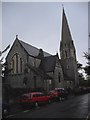
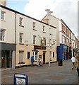
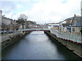
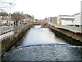
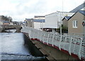
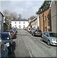
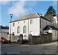
CF31 4AA is a small, densely populated residential postcode in Bridgend, Wales, covering just 8,266 square metres. With 1,882 residents, it is one of the most compact areas in the region, translating to a population density of 227,670 people per square kilometre. This area lies within the historic Bridgend Community, a civil parish formed in 1974 and expanded in 1996 to include parts of the former Ewenny community. Its roots trace back to medieval times, with the original settlement centred on the River Ogmore. Today, the area blends historical significance with modern living, offering proximity to Bridgend’s rail network and retail hubs. The high population density suggests a tightly knit community, though the small size means amenities and services are concentrated. For those seeking a compact, well-connected home, CF31 4AA combines practicality with a sense of local identity, anchored by Bridgend’s historical role as a market town. Its residents benefit from proximity to rail links and a range of retail options, making it a viable choice for commuters and families alike.
- Area Type
- Postcode
- Area Size
- 8266 m²
- Population
- 1882
- Population Density
- 2574 people/km²
CF31 4AA is predominantly an owner-occupied area, with 78% of homes owned by residents rather than rented. The accommodation type is primarily houses, suggesting a mix of detached and semi-detached properties. Given the area’s small size and high population density, the housing stock is limited, which may make it a competitive market for buyers. The concentration of houses rather than flats or apartments indicates a preference for private, standalone living spaces. For prospective buyers, this means a focus on established homes rather than newer developments. The area’s proximity to Bridgend’s rail network and retail amenities may enhance its appeal, though the small size of CF31 4AA means buyers should consider nearby areas for additional options. The high home ownership rate also suggests a stable market, with fewer short-term rental properties disrupting the local housing landscape.
House Prices in CF31 4AA
Showing 1 properties
| Address | Type | Beds | Baths | Last Sale Price | Last Sale Date | |
|---|---|---|---|---|---|---|
| Job Centre Plus, Crown Buildings, Angel Street, Bridgend, CF31 4AA | commercial | - | - | - | - |
Energy Efficiency in CF31 4AA
Residents of CF31 4AA have access to a range of nearby amenities, including five retail outlets such as Iceland Bridgend, Spar, and Tesco Bridgend. These shops provide convenience for daily errands, from groceries to household supplies. The area’s proximity to rail stations like Bridgend Railway Station and Sarn Railway Station enhances mobility, connecting residents to broader networks for work, leisure, or socialising. While the data does not specify parks or leisure facilities, the compact nature of the area suggests that nearby green spaces or recreational areas may be accessible within a short distance. The combination of retail options and rail connectivity contributes to a practical lifestyle, where essentials are within reach and travel is efficient. The small size of CF31 4AA means that amenities are concentrated, reducing the need for long commutes to access services.
Amenities
Schools
The nearest school to CF31 4AA is Ysgol Bryn Castell, which is categorised as an ‘other’ school type. No specific Ofsted rating is provided in the data, so its performance is not quantified. The absence of additional schools in the data means families must look beyond CF31 4AA for further educational options. The presence of a single school suggests that parents may need to consider commuting to nearby areas for secondary or specialist education. While the data does not specify the school’s curriculum or facilities, its existence indicates a basic level of local provision. For families prioritising proximity to schools, CF31 4AA may require supplementary research into nearby institutions to ensure alignment with educational needs.
| Rank | School | Type | Entry gender | Ages |
|---|
Explore more schools in this area
Go to Schools tabDemographics
The population of CF31 4AA is predominantly composed of adults aged 30–64, with a median age of 47. This suggests a mature, stable community with a strong presence of working-age individuals. Home ownership is high at 78%, reflecting a preference for long-term residency over rental properties. The accommodation type is primarily houses, indicating a mix of single-family homes and possibly semi-detached properties. The predominant ethnic group is White, though no further breakdown of diversity is provided. The area’s high population density—227,670 people per square kilometre—suggests a compact, efficient use of space, which may influence the character of daily life. While no specific data on deprivation is available, the high home ownership and age profile imply a relatively stable socioeconomic environment. This demographic profile positions CF31 4AA as a place where families and professionals coexist, with a focus on established, owner-occupied housing.
Household Size
Accommodation Type
Tenure
Ethnic Group
Religion
Household Composition
Age
Household Deprivation
NS-SEC
Explore more demographic insights in this area
Go to Demographics tabPlanning
Planning Constraints
- Flood RiskPremium
- Ramsar Wetland SitesPremium
- Area of Outstanding Natural BeautyPremium
- Protected Nature ReservePremium
- Protected WoodlandPremium
- Crime RiskPremium