Area Overview for CF31 2DD
Photos of CF31 2DD

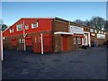
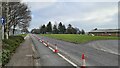
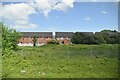
13 photos from this area
Area Information
Key information about the CF31 2DD including its size, population, and administrative classification.
- Area Type
- Postcode
- Area Size
- 1.9 hectares
- Population
- 2170
- Population Density
- 5945 people/km²
House Prices in CF31 2DD
73
Properties
£163,803
Average Sold Price
£104,000
Lowest Price
£331,000
Highest Price
Showing 73 properties
| Address | Type | Beds | Baths | Last Sale Price | Last Sale Date | |
|---|---|---|---|---|---|---|
| 59 Longacres, Bridgend, CF31 2DD | house | - | - | £153,000 | May 2025 | |
| 70 Longacres, Bridgend, CF31 2DD | Detached | 4 | 2 | £290,000 | Mar 2025 | |
| 61 Longacres, Bridgend, CF31 2DD | Terraced | 2 | 1 | £158,250 | Jan 2025 | |
| 24 Longacres, Bridgend, CF31 2DD | Terraced | 3 | 1 | £190,000 | Jun 2024 | |
| 57 Longacres, Bridgend, CF31 2DD | Semi-detached | 3 | 2 | £222,500 | Feb 2024 | |
| 19 Longacres, Bridgend, CF31 2DD | Semi-detached | 3 | 1 | £192,000 | Dec 2023 | |
| 31 Longacres, Bridgend, CF31 2DD | Terraced | 3 | 1 | £197,000 | Dec 2023 | |
| 58 Longacres, Bridgend, CF31 2DD | Terraced | 2 | 1 | £155,000 | Nov 2023 | |
| 53 Longacres, Bridgend, CF31 2DD | Terraced | 3 | 2 | £202,500 | Nov 2023 | |
| 11 Longacres, Bridgend, CF31 2DD | Detached | 2 | 1 | £147,000 | Jul 2023 |
Page 1 of 8
Energy Efficiency in CF31 2DD
Amenities
Schools
| Rank | School | Type | Entry gender | Ages |
|---|
Explore more schools in this area
Go to Schools tabDemographics
Household Size
Two person
most common
Accommodation Type
Houses
most common
Tenure
64
majority
Ethnic Group
White
most common
Religion
N/A
most common
Household Composition
N/A
most common
Age
47
median
Adults (30-64 years)
most common
Household Deprivation
N/A
with no deprivation
NS-SEC
33
in Lower managerial occupations
Explore more demographic insights in this area
Go to Demographics tabPlanning
Planning Constraints
- Flood RiskPremium
- Ramsar Wetland SitesPremium
- Area of Outstanding Natural BeautyPremium
- Protected Nature ReservePremium
- Protected WoodlandPremium
- Crime RiskPremium