Area Overview for CF31 1JG
Photos of CF31 1JG
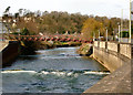

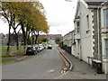
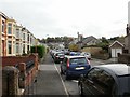
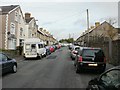
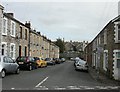
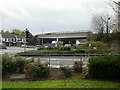
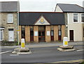
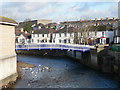
100 photos from this area
Area Information
Key information about the CF31 1JG including its size, population, and administrative classification.
- Area Type
- Postcode
- Area Size
- 1.5 hectares
- Population
- 1654
- Population Density
- 3256 people/km²
House Prices in CF31 1JG
12
Properties
£135,700
Average Sold Price
£62,500
Lowest Price
£210,000
Highest Price
Showing 12 properties
| Address | Type | Beds | Baths | Last Sale Price | Last Sale Date | |
|---|---|---|---|---|---|---|
| Fairfield, Quarella, Wildmill, Bridgend, CF31 1JG | Bungalow | - | - | £106,000 | Nov 2019 | |
| Orchard Bungalow, Quarella, Wildmill, Bridgend, CF31 1JG | Bungalow | 4 | 1 | £210,000 | Feb 2018 | |
| Hilltop, Quarella, Wildmill, Bridgend, CF31 1JG | Semi-detached | 2 | - | £134,000 | Apr 2014 | |
| Barclay Bungalow, Quarella, Wildmill, Bridgend, CF31 1JG | Bungalow | 4 | - | £166,000 | Sep 2010 | |
| Florella, Quarella, Wildmill, Bridgend, CF31 1JG | Semi-detached | 3 | 1 | £62,500 | Dec 1999 | |
| Marsena, 0 Quarella, Bridgend, CF31 1JG | Detached | 3 | 1 | - | - | |
| Quarella House, Quarella, Wildmill, Bridgend, CF31 1JG | Detached | 8 | 3 | - | - | |
| Quarella View, Quarella, Wildmill, Bridgend, CF31 1JG | Semi-detached | 4 | 1 | - | - | |
| Woodlands, Quarella, Wildmill, Bridgend, CF31 1JG | Semi-detached | - | - | - | - | |
| Sunnybank, Quarella, Wildmill, Bridgend, CF31 1JG | Detached | - | - | - | - |
Page 1 of 2
Energy Efficiency in CF31 1JG
Amenities
Schools
| Rank | School | Type | Entry gender | Ages |
|---|
Explore more schools in this area
Go to Schools tabDemographics
Household Size
One person
most common
Accommodation Type
Houses
most common
Tenure
52
majority
Ethnic Group
White
most common
Religion
N/A
most common
Household Composition
N/A
most common
Age
47
median
Adults (30-64 years)
most common
Household Deprivation
N/A
with no deprivation
NS-SEC
25
in Lower managerial occupations
Explore more demographic insights in this area
Go to Demographics tabPlanning
Planning Constraints
- Flood RiskPremium
- Ramsar Wetland SitesPremium
- Area of Outstanding Natural BeautyPremium
- Protected Nature ReservePremium
- Protected WoodlandPremium
- Crime RiskPremium