Area Overview for Brackla Community
Photos of Brackla Community

Area Information
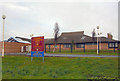
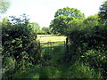
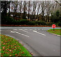
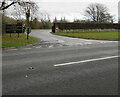
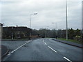
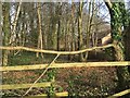
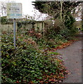
Living in Brackla Community offers a defined experience within Bridgend County Borough, Wales. This civil parish covers an area of 2.6 square kilometres and holds a population of 1,606 residents. The community is situated in the east of Bridgend town and forms part of the wider urban fabric alongside Coychurch Lower. You should understand the local context, as Brackla functions as a large housing estate that has evolved from agricultural land. Historical changes here are significant; the site hosted a Royal Ordnance Factory built by the British Government in 1936 to prepare for potential war with Germany. Nearby industrial areas now lie to the northeast of Bridgend, between the main town and Coity. Remnants of quarries from the industrial era can still be seen in the area today. This distinction between its past as farmland and its current status as a substantial housing community defines daily life. The location benefits from proximity to the adjacent Brackla Industrial Estate and the broader Bridgend Industrial Estate, which developed on former farmland advice since 1936. While the area supports the local economy through these industrial zones, you will find a specific residential character within the parish boundaries. The postcode district is CF31, placing it firmly within the town of Bridgend. Your view of the neighbourhood will likely include industrial heritage features, yet the population density reaches 619 people per square kilometre, indicating a relatively compact living environment.
- Area Type
- Parish
- Area Size
- 2.6 km²
- Population
- 1606
- Population Density
- 619 people/km²
Demographics
The community in Brackla Community displays a distinct age profile that shapes local interactions. The median age for residents is 70 years, reflecting a much older population than the national average. This demographic skew suggests that many families have left while retirees remain, or that new housing attracts older buyers. You should expect to engage with a neighbourhood where the adult population is well-established. Home ownership stands at 65 percent, indicating that the majority of households in this parish own their properties outright or with a mortgage. This figure suggests stability for residents who have settled over a long period. Household composition data indicates general totals without a specific breakdown of family versus single-person homes. Similarly, accommodation types are recorded as a total figure without subdivision into detached, semi-detached, or terraced categories. The predominant ethnic group and religious affiliations are also listed as totals in the available records. These broad statistical categories do not reveal the ethnic or cultural diversity of the street. Despite the lack of granular detail on minority groups, the high home ownership rate often correlates with long-term community attachment. The age distribution means you must consider whether the traditional amenities cater to your specific generation. The population density of 619 people per square kilometre allows for a close living distance from neighbours while maintaining privacy within individual homes.
Household Size
Accommodation Type
Tenure
Ethnic Group
Religion
Household Composition
Age
Household Deprivation
NS-SEC
Explore more demographic insights in this area
Go to Demographics tabPlanning
Planning Constraints
- Flood RiskPremium
- Ramsar Wetland SitesPremium
- Area of Outstanding Natural BeautyPremium
- Protected Nature ReservePremium
- Protected WoodlandPremium
- Crime RiskPremium