Area Overview for North Lanarkshire
Photos of North Lanarkshire
Area Information
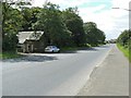
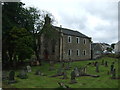
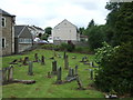
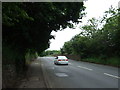
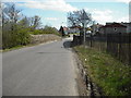
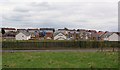
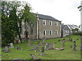
North Lanarkshire is a substantial local authority district covering 472.5 km² within Scotland. Living here means navigating a landscape that accommodates a significant local population across a broad geographical footprint. You are located in an area defined by its administrative structure as a unitary district, which influences how local services and governance operate for residents. Daily life in North Lanarkshire involves engaging with a community that balances urban centres with wider rural stretches. The area serves as a key residential zone, drawing people who seek homes in this specific Scottish locality. You will find that life here is shaped by the distinct character of the district, which houses a variety of neighbourhoods offering different living experiences. Prospective buyers should understand that you are entering a market with a large population spread across a considerable landmass. This context helps frame expectations about travel times, access to amenities, and the general pace of life compared to smaller towns. The sheer size of the district, extending over nearly half a million square metres, means that facilities may feel more distant in peripheral wards compared to town centres. You should be prepared for a living environment that reflects the scale of a major Scottish borough. Understanding the physical extent of North Lanarkshire is essential for assessing your daily commute and lifestyle, particularly if you work outside the immediate vicinity of your chosen property.
- Area Type
- District/Borough
- Area Size
- 472.5 km²
- Population
- Not available
- Population Density
- Not available
Demographics
The community within North Lanarkshire reflects a specific demographic profile that informs the local housing demand. Data indicates that a notable portion of the population consists of households acting as two people without children who have grown up. This demographic segment can influence the type of homes in specific neighbourhoods and the demand for family-sized properties. You will encounter a community where working couples form a significant criteria for buyer preferences. The area also features a strong group of retired people living alone, which suggests a steady demand for single-storey homes or properties with lower maintenance requirements. Children under five represent a smaller but present cohort, indicating ongoing need for schools near North Lanarkshire and family-oriented parcels. For those considering buying, the mix of groups means the housing stock caters to varied life stages. Deprivation levels reveal that 24.6% of the resident population is considered relatively deprived, a statistic that directly impacts your purchasing power and the likely condition of some homes. In contrast, 27.4% of residents live in the most affluent areas, driving market values in specific pockets of the district. These figures show a community with clear economic stratification, meaning you will need to research which parts of North Lanarkshire align with your budget and access to high-quality amenities.
Household Size
Accommodation Type
Tenure
Ethnic Group
Religion
Household Composition
Age
Household Deprivation
NS-SEC
Explore more demographic insights in this area
Go to Demographics tabPlanning
Planning Constraints
- Flood RiskPremium
- Ramsar Wetland SitesPremium
- Area of Outstanding Natural BeautyPremium
- Protected Nature ReservePremium
- Protected WoodlandPremium
- Crime RiskPremium