Area Overview for Falkirk
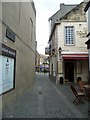
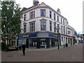
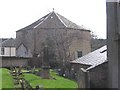
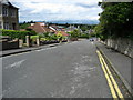
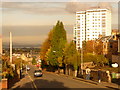
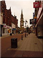
Photos of Falkirk
Area Information
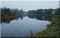
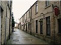
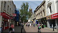
Falkirk stands as a distinct local authority district and unitary council area within Scotland, covering an extensive land mass of 314.9 km². Established as a local authority on 1 April 1996, this region encompasses the eastern end of historic Stirlingshire and western parts of West Lothian. The area centres around the town of Falkirk, located at coordinates approximately 55.9973°N, 3.7907°W. Life here is defined by its administrative uniqueness as one of 32 unitary areas and its deep historical roots. The site holds Roman origins featuring the Antonine Wall and associated forts, which shaped the landscape long before the modern settlement emerged. The medieval settlement developed near the original church, belonging to the Abbotskerse barony owned by Holyrood Abbey. Families such as the Callendars and Livingstons held the nearby Callendar lands until 1715, leaving a legacy in the local architecture and place names. History marks the community profoundly, highlighted by the First Battle of Falkirk fought in July 1298. The burgh's governance evolved significantly over the centuries, with the Town Council formally established in 1833 under the Burgh Reform Act. Further administrative powers followed via the 1859 Falkirk Police and Improvement Act, leading to the modern council area structure. Living in Falkirk means residing in a region where layered history continues to influence the present-day character of the neighbourhoods.
- Area Type
- District/Borough
- Area Size
- 314.9 km²
- Population
- Not available
- Population Density
- Not available
Demographics
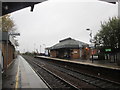
The demographic profile of Falkirk reflects a specific composition of households and residents within this local authority district. You will find a community defined by particular age distributions and household structures that shape daily life. Accommodation types vary across the 314.9 km² of the district, offering different living arrangements for families and individuals. The population resides in homes that range from historic properties with medieval origins to modern developments established after 1996. Ownership levels and tenure arrangements determine how people interact with their neighbourhoods in Falkirk. Some residents own their properties outright, while others hold them on rent. The mix of owner-occupied homes and rental properties creates a dynamic housing stock where financial circumstances influence residential stability. Deprivation indices provide context for the quality of life across different parts of the district, indicating areas where resources may be tighter or services more accessible. You may encounter families situated near schools that have served the community for generations, alongside newer arrivals establishing themselves in different parts of the borough. The social fabric is woven from these varying household types, creating a community where economic status often dictates neighbourhood outcomes. Understanding these demographic nuances is essential when evaluating what living in Falkirk truly entails for a potential buyer.
Household Size
Accommodation Type
Tenure
Ethnic Group
Religion
Household Composition
Age
Household Deprivation
NS-SEC
Explore more demographic insights in this area
Go to Demographics tabPlanning
Planning Constraints
- Flood RiskPremium
- Ramsar Wetland SitesPremium
- Area of Outstanding Natural BeautyPremium
- Protected WoodlandPremium
- Crime RiskPremium