Area Overview for Clackmannanshire
Photos of Clackmannanshire

Area Information
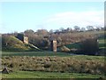
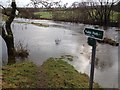
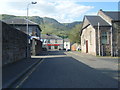
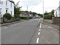
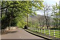
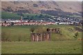
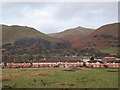
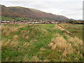
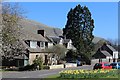
Clackmannanshire stands as a distinct local authority district in Scotland, covering an area of 1,640 square kilometres. This expansive territory offers a stark contrast to the dense urban environments many home buyers expect. Living in Clackmannanshire means embracing open spaces and a quieter pace of life across a single administrative region. The district functions as a unitary authority, meaning you deal with one council for all local services rather than navigating multiple layers of local government. You will find that daily life here revolves around vast landscapes rather than city centres or shopping districts. The sheer size of the district, at 164 square kilometres, ensures that travel times between settlements can be significant compared to more compact towns. Prospective residents must consider whether this rural character suits their lifestyle preferences. There are no nearby major cities screaming for your attention; instead, the area demands a higher reliance on personal transport or digital tools to connect with the wider world. This setting provides significant peace and quiet for those who prioritise space over convenience. However, you must accept that engaging with the broader economy or accessing specialist services requires travelling beyond the district boundaries. The journey itself becomes part of the living experience here.
- Area Type
- District/Borough
- Area Size
- 164.0 km²
- Population
- Not available
- Population Density
- Not available
Demographics
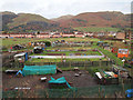
The demographic profile of Clackmannanshire reflects a community driven by specific housing market dynamics rather than a diverse population spread. Recent census data indicates that 75.6 per cent of residents live in overcrowded households. This figure represents more than three quarters of the local population and suggests a significant portion of families share living spaces with more people than is often comfortable for them. Such high household overcrowding typically correlates with low home ownership rates and limited housing stock within the district. Consequently, many residents likely rent accommodation or live with extended family due to financial constraints or lack of available space. While specific age bracket percentages or the exact count of elderly versus young families are not detailed in the current figures, the overcrowding ratio paints a clear picture of affordability challenges. This reality affects the day-to-day quality of life for anyone considering homes in Clackmannanshire. You might find that finding a spacious, single-family home could be difficult without facing competitive pressures or limited options. The community is defined largely by economic factors that force households to adapt their living arrangements. When evaluating schools near Clackmannanshire or choosing a neighbourhood, you must weigh these housing conditions carefully. The data suggests a community where space is at a premium for many households.
Household Size
Accommodation Type
Tenure
Ethnic Group
Religion
Household Composition
Age
Household Deprivation
NS-SEC
Explore more demographic insights in this area
Go to Demographics tabPlanning
Planning Constraints
- Flood RiskPremium
- Ramsar Wetland SitesPremium
- Area of Outstanding Natural BeautyPremium
- Protected Nature ReservePremium
- Protected WoodlandPremium
- Crime RiskPremium