Area Overview for East Dunbartonshire
Photos of East Dunbartonshire
Area Information
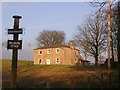
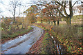
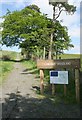
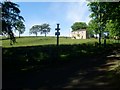
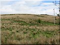
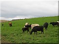
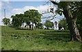
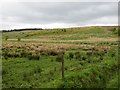
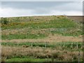
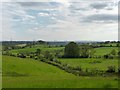
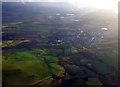
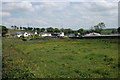
East Dunbartonshire stands as one of Scotland's thirty-two unitary council areas, occupying a strategic position in west-central Scotland immediately to the northeast of Glasgow. You find this district covers an area size of 174.5 km², containing a population of almost 110,000 residents. Living in East Dunbartonshire means residing in a region that borders Glasgow City Council Area to the south, North Lanarkshire to the east, Stirling to the north, and West Dunbartonshire to the west. The council area serves as a collection of suburbs and commuter towns, effectively acting as a satellite for the wider Greater Glasgow area. Among the places you might call home are Bearsden, Milngavie, Bishopbriggs, Kirkintilloch, Lenzie, Twechar, Milton of Campsie, Balmore, and Torrance. Bearsden and Milngavie form the largest settlements in the southwest, while Kirkintilloch dominates in the southeast. The district spans parts of three historic counties: Dunbartonshire, Lanarkshire, and Stirlingshire. This geographical spread creates a diverse environment for those considering homes in East Dunbartonshire. The area contains notable natural features such as Mugdock Park and the Campsie Fells in the northeast. East Dunbartonshire Council manages the region from their offices at 12 Strathkelvin Place in Kirkintilloch. This location forms part of the Southbank Marina development adjoining the Forth and Clyde Canal. If you are looking at what daily life entails, you will move through thirteen distinct community council areas, including Baldernock, Campsie, and Waterside.
- Area Type
- District/Borough
- Area Size
- 174.5 km²
- Population
- Not available
- Population Density
- Not available
Demographics
The community structure within East Dunbartonshire reflects a settled population residing in a traditional property market. With a population of almost 110,000 residents, the area maintains a high percentage of home ownership compared to broader Scottish averages. This statistic indicates that a significant proportion of households in East Dunbartonshire are owner-occupied rather than renting. The local economy continues to support this trend through specific business development initiatives, including a Digital Development Support Programme and Business Loans Scotland. These resources suggest a stable environment for long-term settlement. The proportion of car ownership is also high within the district, which is typical for a commuter belt suburb. When evaluating who lives here, you are looking at a populace that values independence and mobility. The district was established in 1996 following the Local Government etc. (Scotland) Act 1994, which reorganised local administration. This history dates back to the pre-1975 districts of Bearsden and Milngavie and Strathkelvin. The area does not contain designated Zones of Economic Priority, which often influence deprivation metrics in other parts of the country. Demographically, the population is distributed across thirteen community council areas, allowing for varied local identities. The presence of specific business support opportunities, such as the Digital Development Support Programme, points to an active residential base that includes professionals. This stability is evident in the strong home ownership levels. The high rate of car ownership complements the transport infrastructure, ensuring residents have reliable options for commuting to Glasgow or working locally. These factors combine to create a community focused on established living rather than temporary residential arrangements.
Household Size
Accommodation Type
Tenure
Ethnic Group
Religion
Household Composition
Age
Household Deprivation
NS-SEC
Explore more demographic insights in this area
Go to Demographics tabPlanning
Planning Constraints
- Flood RiskPremium
- Ramsar Wetland SitesPremium
- Area of Outstanding Natural BeautyPremium
- Protected Nature ReservePremium
- Protected WoodlandPremium
- Crime RiskPremium