Area Overview for WF11 8SS
Photos of WF11 8SS
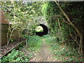
89 photos from this area
Area Information
Key information about the WF11 8SS including its size, population, and administrative classification.
- Area Type
- Postcode
- Area Size
- 1.4 hectares
- Population
- 1410
- Population Density
- 2440 people/km²
House Prices in WF11 8SS
49
Properties
£105,497
Average Sold Price
£34,000
Lowest Price
£195,000
Highest Price
Showing 49 properties
| Address | Type | Beds | Baths | Last Sale Price | Last Sale Date | |
|---|---|---|---|---|---|---|
| 105 Arncliffe Drive, Knottingley, WF11 8SS | Detached | 3 | 1 | £195,000 | Nov 2025 | |
| 83 Arncliffe Drive, Knottingley, WF11 8SS | Terraced | 2 | 1 | £135,000 | Aug 2025 | |
| 90 Arncliffe Drive, Knottingley, WF11 8SS | Terraced | 2 | 1 | £165,000 | May 2025 | |
| 89 Arncliffe Drive, Knottingley, WF11 8SS | Terraced | 2 | 1 | £140,000 | Jan 2024 | |
| 85 Arncliffe Drive, Knottingley, WF11 8SS | Terraced | 2 | 1 | £135,000 | Sep 2023 | |
| 110 Arncliffe Drive, Knottingley, WF11 8SS | Terraced | 3 | 1 | £145,000 | Apr 2023 | |
| 94 Arncliffe Drive, Knottingley, WF11 8SS | Terraced | 2 | 1 | £115,000 | Jan 2022 | |
| 120 Arncliffe Drive, Knottingley, WF11 8SS | house | - | - | £122,000 | Sep 2021 | |
| 87 Arncliffe Drive, Knottingley, WF11 8SS | Terraced | 2 | - | £100,000 | Dec 2020 | |
| 97 Arncliffe Drive, Knottingley, WF11 8SS | Semi-detached | 3 | 1 | £150,000 | Apr 2020 |
Page 1 of 5
Energy Efficiency in WF11 8SS
Amenities
Schools
| Rank | School | Type | Entry gender | Ages |
|---|
Explore more schools in this area
Go to Schools tabDemographics
Household Size
Two person
most common
Accommodation Type
Houses
most common
Tenure
68
majority
Ethnic Group
White
most common
Religion
N/A
most common
Household Composition
N/A
most common
Age
47
median
Adults (30-64 years)
most common
Household Deprivation
N/A
with no deprivation
NS-SEC
21
in Lower managerial occupations
Explore more demographic insights in this area
Go to Demographics tabPlanning
Planning Constraints
- Flood RiskPremium
- Ramsar Wetland SitesPremium
- Area of Outstanding Natural BeautyPremium
- Protected Nature ReservePremium
- Protected WoodlandPremium