Area Overview for S10 5FE
Photos of S10 5FE
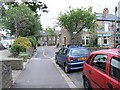
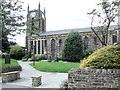
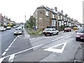
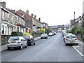
95 photos from this area
Area Information
Key information about the S10 5FE including its size, population, and administrative classification.
- Area Type
- Postcode
- Area Size
- 6859 m²
- Population
- 1617
- Population Density
- 5666 people/km²
House Prices in S10 5FE
40
Properties
£203,707
Average Sold Price
£650
Lowest Price
£360,000
Highest Price
Showing 40 properties
| Address | Type | Beds | Baths | Last Sale Price | Last Sale Date | |
|---|---|---|---|---|---|---|
| 77 Evelyn Road, Sheffield, S10 5FE | Terraced | 3 | 2 | £350,000 | Jun 2025 | |
| 5 Evelyn Road, Sheffield, S10 5FE | Terraced | 3 | 2 | £290,000 | Dec 2024 | |
| 57 Evelyn Road, Sheffield, S10 5FE | Terraced | 3 | 1 | £241,650 | Jul 2024 | |
| 39 Evelyn Road, Sheffield, S10 5FE | Terraced | 3 | 1 | £231,500 | Apr 2024 | |
| 61 Evelyn Road, Sheffield, S10 5FE | Terraced | 3 | 1 | £228,500 | Jan 2024 | |
| 35 Evelyn Road, Sheffield, S10 5FE | Terraced | 3 | 2 | £308,700 | Nov 2023 | |
| 17 Evelyn Road, Sheffield, S10 5FE | Terraced | 3 | 1 | £260,000 | Jul 2023 | |
| 21 Evelyn Road, Sheffield, S10 5FE | Terraced | 3 | 1 | £245,000 | Feb 2023 | |
| 73 Evelyn Road, Sheffield, S10 5FE | Terraced | 3 | - | £255,000 | Dec 2022 | |
| 53 Evelyn Road, Sheffield, S10 5FE | Terraced | 3 | 1 | £360,000 | Dec 2022 |
Page 1 of 4
Energy Efficiency in S10 5FE
Amenities
Schools
| Rank | School | Type | Entry gender | Ages |
|---|
Explore more schools in this area
Go to Schools tabDemographics
Household Size
Two person
most common
Accommodation Type
Houses
most common
Tenure
72
majority
Ethnic Group
White
most common
Religion
N/A
most common
Household Composition
N/A
most common
Age
47
median
Adults (30-64 years)
most common
Household Deprivation
N/A
with no deprivation
NS-SEC
47
in Lower managerial occupations
Explore more demographic insights in this area
Go to Demographics tabPlanning
Planning Constraints
- Flood RiskPremium
- Ramsar Wetland SitesPremium
- Area of Outstanding Natural BeautyPremium
- Protected Nature ReservePremium
- Protected WoodlandPremium