Area Overview for LS28 5SE
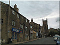
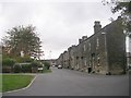
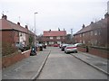
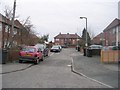
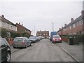
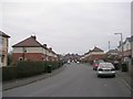
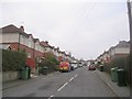
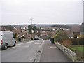
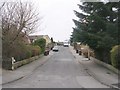
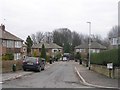
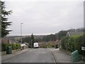
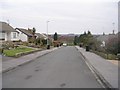
Photos of LS28 5SE
Area Information
LS28 5SE is a small residential postcode in west Leeds, covering 3,716 square metres and home to 1,612 people. Its population density is exceptionally high at 433,852 people per square kilometre, reflecting a compact, closely knit community. The area lies within the Calverley and Farsley electoral ward, a historically significant region with ties to medieval heritage. Calverley Old Hall, a 14th-century manor, stands as a tangible link to the past, while the A657 road connects the area to nearby towns like Pudsey and Bradford. Daily life here is shaped by its proximity to retail hubs such as Co-op Farsley and Asda Pudsey, and its accessibility to rail networks, including New Pudsey and Bramley stations. The median age of 47 suggests a mature population, with many residents in their 30s to 60s. This is a place where history meets modern convenience, offering a quiet residential environment with practical amenities within reach.
- Area Type
- Postcode
- Area Size
- 3716 m²
- Population
- 1612
- Population Density
- 4291 people/km²
LS28 5SE is characterised by a high rate of home ownership (66%) and a predominance of houses, which suggests a focus on family-oriented living. The compact size of the postcode means the housing stock is likely limited, with properties concentrated in a small geographical area. This could make the market competitive for buyers seeking homes in the immediate vicinity. The presence of houses rather than flats or apartments aligns with the area’s demographic profile, which skews towards older adults and families. However, the small size of the postcode may restrict the variety of properties available, meaning buyers may need to consider nearby areas for more options. The high population density, despite the small area, indicates that properties here are likely to be in close proximity to each other, with limited green space or large developments.
House Prices in LS28 5SE
Showing 3 properties
| Address | Type | Beds | Baths | Last Sale Price | Last Sale Date | |
|---|---|---|---|---|---|---|
| 2 Edroyd Gardens, Farsley, Pudsey, LS28 5SE | house | - | - | £320,000 | Jul 2023 | |
| 1 Edroyd Gardens, Farsley, Pudsey, LS28 5SE | house | - | - | £320,000 | Feb 2023 | |
| 3 Edroyd Gardens, Farsley, Pudsey, LS28 5SE | Detached | 4 | 2 | - | - |
Energy Efficiency in LS28 5SE
Residents of LS28 5SE have access to a range of local amenities within practical reach. Retail options include Co-op Farsley, Asda Pudsey, and Lidl Bramley, ensuring everyday shopping needs are met. The area is served by five railway stations, including New Pudsey and Bramley, providing easy access to public transport. Nearby, Leeds Bradford International Airport is a short drive away, offering regional and international flight connections. While the area’s historical features, such as Calverley Old Hall, are notable, the modern lifestyle is supported by these amenities. The combination of retail, transport links, and proximity to airports creates a convenient living environment. However, the absence of detailed information on parks or leisure facilities means buyers should explore the immediate surroundings for recreational opportunities.
Amenities
Schools
| Rank | School | Type | Entry gender | Ages |
|---|
Explore more schools in this area
Go to Schools tabDemographics
The population of LS28 5SE is predominantly adults aged 30–64, with a median age of 47. Home ownership is strong, at 66%, indicating a stable, long-term resident base. The area is primarily composed of houses, reflecting a family-oriented housing stock. The predominant ethnic group is White, making up the majority of the population. However, the ward’s broader context reveals a more diverse demographic, with Asian residents comprising 13.8% of the wider area. Deprivation levels in the ward are mid-range, with 81.9% of the population falling into this category. This suggests that while basic needs are generally met, there may be limited access to higher-tier services or opportunities compared to less deprived areas. The high population density, combined with a mature age profile, indicates a community that prioritises stability and proximity to essential services over expansion.
Household Size
Accommodation Type
Tenure
Ethnic Group
Religion
Household Composition
Age
Household Deprivation
NS-SEC
Explore more demographic insights in this area
Go to Demographics tabPlanning
Planning Constraints
- Flood RiskPremium
- Ramsar Wetland SitesPremium
- Area of Outstanding Natural BeautyPremium
- Protected Nature ReservePremium
- Protected WoodlandPremium