Area Overview for DN37 0RF
Photos of DN37 0RF
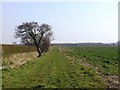
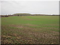
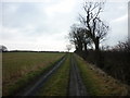
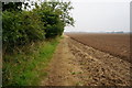
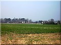
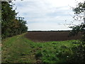
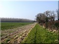
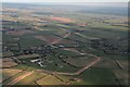
8 photos from this area
Area Information
Key information about the DN37 0RF including its size, population, and administrative classification.
- Area Type
- Postcode
- Area Size
- 59.4 hectares
- Population
- 1428
- Population Density
- 128 people/km²
House Prices in DN37 0RF
47
Properties
£263,238
Average Sold Price
£47,500
Lowest Price
£740,000
Highest Price
Showing 47 properties
| Address | Type | Beds | Baths | Last Sale Price | Last Sale Date | |
|---|---|---|---|---|---|---|
| Langdale, Main Road, Brigsley, DN37 0RF | Detached | 4 | 1 | £387,500 | Oct 2024 | |
| Golden Pond, Main Road, Brigsley, DN37 0RF | house | - | - | £699,950 | Jan 2021 | |
| 6 Main Road, Brigsley, DN37 0RF | house | 2 | 1 | £219,000 | Nov 2020 | |
| Alicia, Main Road, Brigsley, DN37 0RF | Detached | 4 | 1 | £350,000 | Sep 2019 | |
| 7 Main Road, Brigsley, DN37 0RF | house | - | - | £165,000 | Mar 2019 | |
| Tanglin, Main Road, Brigsley, DN37 0RF | Detached | 8 | 2 | £675,000 | Sep 2018 | |
| Tree Top House, Main Road, Brigsley, DN37 0RF | Bungalow | - | - | £335,000 | Sep 2018 | |
| Waterdell, Main Road, Brigsley, DN37 0RF | house | 3 | - | £335,000 | Jul 2017 | |
| The Beeches, Main Road, Brigsley, DN37 0RF | house | - | - | £288,000 | Mar 2017 | |
| Highwood, Main Road, Brigsley, DN37 0RF | house | - | - | £180,000 | Jul 2016 |
Page 1 of 5
Energy Efficiency in DN37 0RF
Amenities
Schools
| Rank | School | Type | Entry gender | Ages |
|---|
Explore more schools in this area
Go to Schools tabDemographics
Household Size
Two person
most common
Accommodation Type
Houses
most common
Tenure
89
majority
Ethnic Group
White
most common
Religion
N/A
most common
Household Composition
N/A
most common
Age
47
median
Adults (30-64 years)
most common
Household Deprivation
N/A
with no deprivation
NS-SEC
35
in Lower managerial occupations
Explore more demographic insights in this area
Go to Demographics tabPlanning
Planning Constraints
- Flood RiskPremium
- Ramsar Wetland SitesPremium
- Area of Outstanding Natural BeautyPremium
- Protected Nature ReservePremium
- Protected WoodlandPremium