Area Overview for DN37 0RJ
Photos of DN37 0RJ
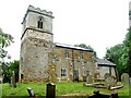
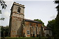
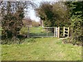

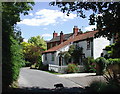
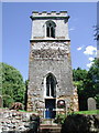
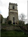
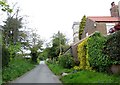
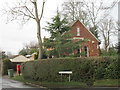
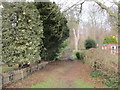
63 photos from this area
Area Information
Key information about the DN37 0RJ including its size, population, and administrative classification.
- Area Type
- Postcode
- Area Size
- 68.0 hectares
- Population
- 1428
- Population Density
- 128 people/km²
House Prices in DN37 0RJ
24
Properties
£350,455
Average Sold Price
£125,000
Lowest Price
£1,050,000
Highest Price
Showing 24 properties
| Address | Type | Beds | Baths | Last Sale Price | Last Sale Date | |
|---|---|---|---|---|---|---|
| The Shambles, Waithe Lane, Brigsley, DN37 0RJ | house | 4 | 1 | £415,000 | May 2020 | |
| Wold View, Waithe Lane, Brigsley, DN37 0RJ | Bungalow | - | - | £282,000 | Aug 2017 | |
| Blackbirds, Waithe Lane, Brigsley, DN37 0RJ | Bungalow | 4 | 2 | £280,000 | Jun 2017 | |
| Ash Holt, Waithe Lane, Brigsley, DN37 0RJ | house | - | - | £1,050,000 | Apr 2017 | |
| Southlands, Waithe Lane, Brigsley, DN37 0RJ | Detached | 3 | 1 | £294,000 | Aug 2015 | |
| Wheatlands, Waithe Lane, Brigsley, DN37 0RJ | Bungalow | 3 | - | £245,000 | Mar 2014 | |
| Swallows Rest, Waithe Lane, Brigsley, DN37 0RJ | Bungalow | 4 | 2 | £294,000 | Dec 2007 | |
| High Bannerdown, Waithe Lane, Brigsley, DN37 0RJ | Detached | - | - | £370,000 | May 2007 | |
| Ardus, Waithe Lane, Brigsley, DN37 0RJ | Bungalow | 2 | - | £340,000 | Jan 2004 | |
| The Thatch, Waithe Lane, Brigsley, DN37 0RJ | Detached | 4 | 1 | £160,000 | Dec 1996 |
Page 1 of 3
Energy Efficiency in DN37 0RJ
Amenities
Schools
| Rank | School | Type | Entry gender | Ages |
|---|
Explore more schools in this area
Go to Schools tabDemographics
Household Size
Two person
most common
Accommodation Type
Houses
most common
Tenure
89
majority
Ethnic Group
White
most common
Religion
N/A
most common
Household Composition
N/A
most common
Age
47
median
Adults (30-64 years)
most common
Household Deprivation
N/A
with no deprivation
NS-SEC
35
in Lower managerial occupations
Explore more demographic insights in this area
Go to Demographics tabPlanning
Planning Constraints
- Flood RiskPremium
- Ramsar Wetland SitesPremium
- Area of Outstanding Natural BeautyPremium
- Protected Nature ReservePremium
- Protected WoodlandPremium