Area Overview for DN37 0LF
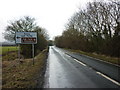
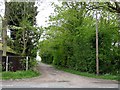
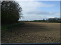
Photos of DN37 0LF


Area Information
Living in DN37 0LF means being part of a tightly knit residential cluster in England’s Lincolnshire region. This small area spans 34.4 hectares and is home to 1,428 people, with a population density of 128 people per square kilometre. The community is compact, with homes predominantly in single-family structures, reflecting a stable, long-term demographic. Daily life here is shaped by proximity to rail networks, with five nearby stations offering access to Grimsby and beyond. The area’s low crime risk score of 83 and minimal flood risk make it an attractive option for those prioritising safety and environmental stability. While it lacks large-scale amenities, its practical layout and quiet surroundings cater to those seeking a balanced, low-maintenance lifestyle. The presence of local shops, including Spar and Lincolnshire Co-operative Co, ensures essential needs are met without the need to travel far. DN37 0LF is not a place for those seeking urban vibrancy but suits those who value simplicity, security, and a connection to local transport hubs.
- Area Type
- Postcode
- Area Size
- 34.4 hectares
- Population
- 1428
- Population Density
- 128 people/km²
The property market in DN37 0LF is characterised by high home ownership (89%) and a focus on single-family homes. This suggests a market dominated by owner-occupied properties rather than rental units, which is uncommon in many modern housing areas. The absence of flats or high-density housing means the area’s housing stock is limited, with fewer options for buyers seeking alternative property types. Given the small size of the area—34.4 hectares—there is little scope for expansion, making the market potentially competitive for those looking to purchase. The prevalence of houses indicates a preference for traditional, spacious living, which may appeal to families or individuals prioritising privacy and space. However, buyers should be aware that the limited supply could mean fewer choices and potentially higher prices. The market’s stability, combined with low crime and environmental risks, positions DN37 0LF as a secure but niche option for property buyers.
House Prices in DN37 0LF
Showing 2 properties
| Address | Type | Beds | Baths | Last Sale Price | Last Sale Date | |
|---|---|---|---|---|---|---|
| Plot, Brigsley Road, Ashby Cum Fenby, DN37 0LF | Detached | - | - | - | - | |
| Moorhouse Farm, Brigsley Road, Ashby Cum Fenby, DN37 0LF | house | - | - | - | - |
Energy Efficiency in DN37 0LF
The lifestyle in DN37 0LF is defined by practicality and proximity to essential services. Within walking distance are five retail outlets, including Spar and two Lincolnshire Co-operative Co stores, ensuring residents can access groceries, essentials, and local services without needing to travel far. The rail network is a key feature, with five stations providing links to Grimsby and surrounding areas, making commuting or day trips straightforward. While the area lacks large parks or entertainment venues, its compact size means amenities are concentrated, reducing the need for long journeys. The absence of major leisure facilities means the community is more focused on daily necessities than recreation, but the quiet, low-density environment offers a calm alternative to busier regions. For those who prioritise convenience over luxury, DN37 0LF’s straightforward access to shops and transport creates a functional, no-frills lifestyle.
Amenities
Schools
| Rank | School | Type | Entry gender | Ages |
|---|
Explore more schools in this area
Go to Schools tabDemographics
The residents of DN37 0LF are predominantly adults aged 30 to 64, with a median age of 47. This suggests a mature, established community with strong ties to the area. Home ownership is exceptionally high at 89%, indicating a stable housing market where most residents live in their own homes rather than renting. The accommodation type is almost exclusively houses, reflecting a lack of high-density housing or flats. The predominant ethnic group is White, with no specific data provided on other demographics. The age profile and ownership figures suggest a population that is largely settled, with few young families or transient residents. This stability contributes to a low crime risk score of 83, reinforcing the area’s reputation for safety. The absence of detailed diversity metrics means the community’s social composition remains largely homogenous, which may appeal to those seeking a predictable, cohesive environment.
Household Size
Accommodation Type
Tenure
Ethnic Group
Religion
Household Composition
Age
Household Deprivation
NS-SEC
Explore more demographic insights in this area
Go to Demographics tabPlanning
Planning Constraints
- Flood RiskPremium
- Ramsar Wetland SitesPremium
- Area of Outstanding Natural BeautyPremium
- Protected Nature ReservePremium
- Protected WoodlandPremium