Area Overview for DN37 0QF
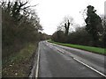
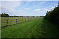
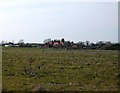
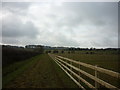
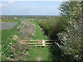
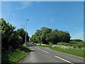
Photos of DN37 0QF


Area Information
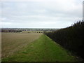
DN37 0QF is a compact residential postcode in England, covering 58.3 hectares and home to 1,428 residents. Its low population density of 128 people per square kilometre suggests a quiet, spread-out community rather than a densely packed urban area. This small cluster of homes is likely to feel close-knit, with a focus on local living rather than high-rise development. The area’s character is shaped by its modest size and the demographic profile of its residents, who are predominantly adults aged 30–64. With a median age of 47, the community appears stable, with a strong presence of homeowners. Daily life here is likely to revolve around nearby amenities, such as retail outlets and rail stations, which provide access to broader services. The absence of major environmental constraints, such as protected woodlands or flood-prone zones, adds to the area’s appeal for those seeking a straightforward, low-risk living environment. For buyers, DN37 0QF offers a snapshot of rural or semi-rural England, where homes are largely owner-occupied and the pace of life is slower than in larger cities.
- Area Type
- Postcode
- Area Size
- 58.3 hectares
- Population
- 1428
- Population Density
- 128 people/km²
DN37 0QF is predominantly an owner-occupied area, with 89% of homes owned by their residents. This high rate of home ownership suggests a community of long-term residents rather than a transient rental market. The accommodation type is primarily houses, which may indicate a preference for larger properties with gardens or semi-detached layouts. Given the area’s small size—just 58.3 hectares—there is likely limited scope for new housing developments, making the existing stock relatively scarce. Buyers should consider that the market is not driven by speculative investment but by those seeking stable, established homes. The low population density and high home ownership rate also suggest that properties here may hold their value over time, particularly for those prioritising security and a quiet lifestyle. For those looking to purchase, the limited availability of homes could mean competition is higher than in larger areas, but the absence of major environmental or planning constraints may make it an attractive option for buyers seeking a low-maintenance, family-friendly environment.
House Prices in DN37 0QF
Showing 4 properties
| Address | Type | Beds | Baths | Last Sale Price | Last Sale Date | |
|---|---|---|---|---|---|---|
| Cedar Cottage, Ashby Hill, Ashby Cum Fenby, DN37 0QF | house | - | - | £180,000 | Jan 2017 | |
| Caravan, Ashby Hill, Ashby Cum Fenby, DN37 0QF | Mobile Home | - | - | - | - | |
| Wold View Farm, Ashby Hill, Ashby Cum Fenby, DN37 0QF | Farm | - | - | - | - | |
| Bramble Cottage, Ashby Hill, Ashby Cum Fenby, DN37 0QF | Detached | - | - | - | - |
Energy Efficiency in DN37 0QF
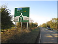
Living in DN37 0QF offers access to a range of local amenities within practical reach. Retail options include Spar, Lincolnshire Co-operative Co, and Morrisons Daily, providing essential shopping for groceries and household items. These stores suggest a focus on convenience, catering to daily needs without requiring long trips. The area’s rail stations—Grimsby Town, Great Coates, and Grimsby Docks—offer easy access to regional transport, linking residents to nearby towns and cities. While the data does not mention parks or leisure facilities explicitly, the absence of environmental constraints such as protected woodlands or AONB designations implies that open spaces may be available for recreational use. The combination of local shops and rail connectivity creates a lifestyle that balances self-sufficiency with the flexibility to travel. For those valuing a mix of quiet living and accessible services, DN37 0QF provides a straightforward, functional environment.
Amenities
Schools
| Rank | School | Type | Entry gender | Ages |
|---|
Explore more schools in this area
Go to Schools tabDemographics
The population of DN37 0QF is 1,428, with a median age of 47. This places the area firmly in the adult demographic, with 30–64-year-olds making up the majority. The high home ownership rate of 89% indicates a community of long-term residents rather than a transient rental market. Most properties are houses, which aligns with the preference for family-oriented or semi-detached living. The predominant ethnic group is White, reflecting the broader demographic patterns of the region. The data does not specify deprivation levels, but the combination of high home ownership and a mature age profile suggests a relatively stable socioeconomic environment. This stability may translate into lower demand for social services and a focus on community cohesion. For buyers, the age demographic implies a market skewed towards older adults or families seeking established homes, rather than younger professionals or students. The area’s character is defined by its residents’ priorities: security, space, and proximity to essential services.
Household Size
Accommodation Type
Tenure
Ethnic Group
Religion
Household Composition
Age
Household Deprivation
NS-SEC
Explore more demographic insights in this area
Go to Demographics tabPlanning
Planning Constraints
- Flood RiskPremium
- Ramsar Wetland SitesPremium
- Area of Outstanding Natural BeautyPremium
- Protected Nature ReservePremium
- Protected WoodlandPremium