Area Overview for DN17 4TB
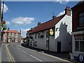
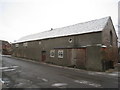
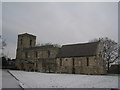
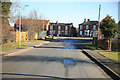
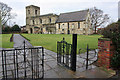
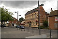
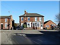
Photos of DN17 4TB

Area Information
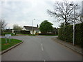
DN17 4TB is a small, low-density postcode area in England, covering 7,813 square metres and home to 1,692 residents. Its sparse population, at 40 people per square kilometre, suggests a quiet, spread-out residential cluster rather than a densely populated town. The area is characterised by its modest size and the presence of established housing stock, with most properties being owner-occupied. Daily life here is likely to revolve around local amenities and community ties, given the manageable scale of the area. Proximity to nearby towns and villages may provide access to more extensive services, while the postcode’s limited footprint ensures a sense of intimacy. The demographic profile, with a median age of 47 and a majority of residents aged 30–64, hints at a stable, family-oriented population. For those considering living in DN17 4TB, the balance between seclusion and practical connectivity is key, with nearby schools and transport links offering essential support.
- Area Type
- Postcode
- Area Size
- 7813 m²
- Population
- 1692
- Population Density
- 40 people/km²
The property market in DN17 4TB is dominated by owner-occupied homes, with 81% of residents living in houses rather than flats or rental properties. This indicates a market skewed towards long-term residents rather than short-term renters. The area’s small size and limited housing stock mean that property availability is constrained, potentially leading to competition among buyers. The prevalence of houses suggests a preference for family homes or larger properties, which may appeal to those seeking space and privacy. However, the lack of high-density housing options could be a limitation for buyers prioritising affordability or investment in rental properties. For those considering DN17 4TB, the market reflects a settled, mature demographic with a focus on residential stability over speculative growth.
House Prices in DN17 4TB
Showing 5 properties
| Address | Type | Beds | Baths | Last Sale Price | Last Sale Date | |
|---|---|---|---|---|---|---|
| 1 Regent Drive, Crowle, DN17 4TB | Bungalow | 2 | 1 | £170,000 | Aug 2022 | |
| 3 Regent Drive, Crowle, DN17 4TB | Detached | - | - | £143,000 | Dec 2003 | |
| 4 Regent Drive, Crowle, DN17 4TB | Detached | - | - | £57,000 | Aug 2000 | |
| 2 Regent Drive, Crowle, DN17 4TB | Detached | - | - | - | - | |
| 5 Regent Drive, Crowle, DN17 4TB | Bungalow | - | - | - | - |
Energy Efficiency in DN17 4TB
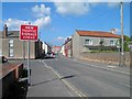
The lifestyle in DN17 4TB is supported by nearby amenities, including five retail venues such as Tesco Crowle, Tesco Scunthorpe, and the Lincolnshire Co-operative Co. These shops provide essential services for daily living, from groceries to household supplies. The presence of four railway stations within practical reach adds convenience for travel, whether for commuting or exploring further afield. While the area itself is small, its proximity to larger towns likely means residents can access a wider range of leisure, dining, and cultural options. The combination of local retail and transport links creates a practical, community-focused lifestyle, balancing self-sufficiency with access to external opportunities.
Amenities
Schools
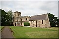
Residents of DN17 4TB have access to two notable schools within practical reach. North Axholme School is a primary institution, providing education for younger children, while The Axholme Academy is an academy with a good Ofsted rating. The presence of both primary and secondary education options within the area offers families a range of choices, reducing the need for long commutes. The Axholme Academy’s good rating suggests a reliable standard of education, which is a key consideration for families prioritising school quality. With these institutions nearby, the area supports a community focused on education and family life, making it appealing to households with children.
| Rank | School | Type | Entry gender | Ages |
|---|
Explore more schools in this area
Go to Schools tabDemographics
The population of DN17 4TB is predominantly adults aged 30–64, with a median age of 47. This suggests a community of established professionals, families, and middle-aged residents. Home ownership is high, with 81% of households owning their homes, indicating a stable, long-term demographic. The area is composed largely of houses rather than flats or apartments, reflecting a traditional residential pattern. The predominant ethnic group is White, though no specific data on diversity or deprivation is provided. The age profile implies a mature population, which may influence local services and amenities. With a low population density, the area likely offers a quieter lifestyle compared to more urban settings. For buyers, the high home ownership rate and age range suggest a community focused on stability rather than transient rental markets.
Household Size
Accommodation Type
Tenure
Ethnic Group
Religion
Household Composition
Age
Household Deprivation
NS-SEC
Explore more demographic insights in this area
Go to Demographics tabPlanning
Planning Constraints
- Flood RiskPremium
- Ramsar Wetland SitesPremium
- Area of Outstanding Natural BeautyPremium
- Protected Nature ReservePremium
- Protected WoodlandPremium