Area Overview for DN17 4GH
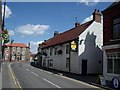
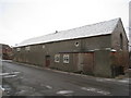
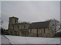
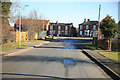
Photos of DN17 4GH


Area Information
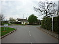
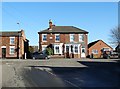
Living in DN17 4GH means being part of a small, tightly knit residential cluster in Lincolnshire. The area covers 9,052 square metres and is home to 1,692 people, spread across a population density of 40 people per square kilometre. This low density suggests a quiet, less congested environment, ideal for those seeking space without urban sprawl. The community is predominantly middle-aged, with a median age of 47, and the majority of residents are homeowners, reflecting a stable, long-term presence. Daily life here is shaped by proximity to essential services, including five retail outlets such as Tesco Crowle and Co-op Petrol, and four nearby railway stations. While the area lacks large-scale amenities, its compact size ensures easy access to local shops and transport links. Families may find the mix of primary and secondary schools nearby appealing, though the small population means the community remains relatively insular. For those prioritising safety, the area scores 79 out of 100 for low crime risk, though flood risk is critical, requiring careful consideration for property buyers. DN17 4GH is not for everyone, but it offers a straightforward, no-frills lifestyle in a rural setting.
- Area Type
- Postcode
- Area Size
- 9052 m²
- Population
- 1692
- Population Density
- 40 people/km²
The property market in DN17 4GH is characterised by high home ownership (81%) and a dominance of houses over flats or apartments. This suggests a market skewed towards owner-occupiers rather than renters, which may limit availability for those seeking short-term housing. The small area size and low population density indicate a limited housing stock, meaning properties are likely to be in high demand relative to supply. For buyers, this means competition for available homes, particularly if they align with the area’s preference for traditional housing. The absence of larger developments or newer builds implies that properties here are likely older, with potential for renovation or modernisation. Given the area’s compact nature, buyers should consider proximity to nearby towns for additional services. While the market may not cater to investors seeking rental yields, it offers stability for those seeking a long-term, low-maintenance home in a rural setting.
House Prices in DN17 4GH
Showing 16 properties
| Address | Type | Beds | Baths | Last Sale Price | Last Sale Date | |
|---|---|---|---|---|---|---|
| 6 Orchard Grange, Crowle, DN17 4GH | Terraced | 2 | 1 | £140,000 | Dec 2024 | |
| 2 Orchard Grange, Crowle, DN17 4GH | house | 3 | - | £163,000 | Mar 2024 | |
| 8 Orchard Grange, Crowle, DN17 4GH | house | - | - | £232,000 | Sep 2018 | |
| 9 Orchard Grange, Crowle, DN17 4GH | Bungalow | 3 | - | £212,000 | Jan 2017 | |
| 14 Orchard Grange, Crowle, DN17 4GH | house | 4 | 2 | £208,000 | Jun 2016 | |
| 11 Orchard Grange, Crowle, DN17 4GH | Detached | 4 | 2 | £225,000 | May 2015 | |
| 16 Orchard Grange, Crowle, DN17 4GH | Detached | 4 | 2 | £230,000 | Nov 2014 | |
| 7 Orchard Grange, Crowle, DN17 4GH | Bungalow | 3 | - | £199,950 | Aug 2013 | |
| 3 Orchard Grange, Crowle, DN17 4GH | house | - | - | £239,000 | Mar 2008 | |
| 5 Orchard Grange, Crowle, DN17 4GH | Detached | 4 | 3 | £240,000 | Dec 2007 |
Energy Efficiency in DN17 4GH
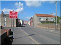
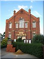
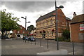
The lifestyle in DN17 4GH is defined by simplicity and proximity to essential services. Within practical reach are five retail outlets, including major names like Tesco Crowle and Lincolnshire Co-operative Co, ensuring everyday shopping needs are met. The area’s rail network, with four stations, provides access to nearby towns and beyond, though the character of the amenities remains modest. There is no mention of parks, leisure facilities, or dining options in the data, suggesting a focus on practicality over recreation. Residents may need to travel further for cultural or entertainment opportunities. The low population density and limited amenities mean the area is ideal for those prioritising convenience over a vibrant social scene. For buyers, this translates to a home that is functional, with minimal fuss, but requires consideration of external resources for a full lifestyle.
Amenities
Schools
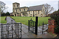
Residents of DN17 4GH have access to two schools within practical reach. North Axholme School is a primary institution, providing education for younger children, while The Axholme Academy is a secondary school with a good Ofsted rating. This combination of primary and secondary education options offers families a straightforward path through the school system without needing to commute far. The presence of a rated academy suggests a commitment to quality education, though the small population of the area may limit class sizes and extracurricular diversity. For parents prioritising school performance, The Axholme Academy’s good rating is a positive sign. However, the absence of specialist or selective schools means the options remain standard for rural areas. Overall, the schools in DN17 4GH cater to basic educational needs but may not offer the breadth of opportunities found in larger towns.
| Rank | School | Type | Entry gender | Ages |
|---|
Explore more schools in this area
Go to Schools tabDemographics
DN17 4GH’s population skews towards adults aged 30–64, with a median age of 47. This suggests a mature, settled community, likely with established careers and family structures. Home ownership is high at 81%, indicating a strong preference for long-term residency over rental properties. The area is composed almost entirely of houses, rather than flats or apartments, which aligns with the demographic profile of older, family-oriented residents. The predominant ethnic group is White, reflecting the broader trends of rural England. While no specific data on deprivation is provided, the high home ownership rate and low population density imply a stable, low-pressure environment. However, the absence of diverse age groups or younger residents may limit social dynamism. For buyers, this means a community with predictable needs and a focus on practical living over trend-driven amenities. The demographic profile of DN17 4GH is clear: it is a place for those prioritising security, space, and a slower pace of life over urban vibrancy.
Household Size
Accommodation Type
Tenure
Ethnic Group
Religion
Household Composition
Age
Household Deprivation
NS-SEC
Explore more demographic insights in this area
Go to Demographics tabPlanning
Planning Constraints
- Flood RiskPremium
- Ramsar Wetland SitesPremium
- Area of Outstanding Natural BeautyPremium
- Protected Nature ReservePremium
- Protected WoodlandPremium