Area Overview for DN17 4GL
Photos of DN17 4GL


Area Information
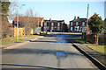
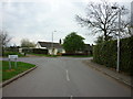
DN17 4GL is a small, tightly knit residential area in England, covering just 1.3 hectares and home to 1,778 residents. Its compact size means it feels intimate, with a population density of 452 people per square kilometre. The area’s character is defined by its older demographic, with a median age of 47 and a majority of residents aged 30–64. This suggests a community of established families and professionals, many of whom own their homes—81% of households are owner-occupied, with houses being the primary accommodation type. Daily life here is likely quiet and stable, with limited commercial activity but strong local connections. The area’s proximity to rail networks and essential retail services ensures practicality, while the absence of major environmental designations means it avoids planning restrictions. However, the high flood risk score of 89.77 is a critical consideration for prospective buyers. Despite this, the low crime risk and reliable broadband connectivity (98/100) make DN17 4GL a mix of practicality and challenge. For those prioritising safety and community over urban amenities, it offers a distinct, if modest, lifestyle.
- Area Type
- Postcode
- Area Size
- 1.3 hectares
- Population
- 1778
- Population Density
- 452 people/km²
DN17 4GL is predominantly an owner-occupied area, with 81% of homes owned by residents rather than rented. The accommodation type is exclusively houses, which suggests a focus on family-friendly, private living rather than flats or apartments. This makes the area appealing to those seeking long-term stability, though the limited size of the postcode (1.3 hectares) means the housing stock is small. Buyers should expect a modest market with few properties available, potentially leading to competition among local residents. The high home ownership rate indicates that the area is not a rental hotspot, which may be a drawback for those needing flexibility. The absence of planning constraints like protected woodlands or Areas of Outstanding Natural Beauty allows for development, though flood risk remains a concern. For those prioritising private, family-oriented housing in a low-crime, low-density setting, DN17 4GL offers a niche but practical option.
House Prices in DN17 4GL
Showing 21 properties
| Address | Type | Beds | Baths | Last Sale Price | Last Sale Date | |
|---|---|---|---|---|---|---|
| 12 Saffron Way, Crowle, DN17 4GL | Terraced | 3 | 1 | £170,000 | Apr 2024 | |
| 4 Saffron Way, Crowle, DN17 4GL | Terraced | 3 | 2 | £177,500 | Aug 2023 | |
| 22 Saffron Way, Crowle, DN17 4GL | Terraced | 2 | 1 | £138,000 | Mar 2023 | |
| 18 Saffron Way, Crowle, DN17 4GL | house | - | - | £174,000 | Oct 2022 | |
| 28 Saffron Way, Crowle, DN17 4GL | house | - | - | £335,000 | Nov 2020 | |
| 24 Saffron Way, Crowle, DN17 4GL | Detached | 5 | - | £310,500 | Nov 2020 | |
| 10 Saffron Way, Crowle, DN17 4GL | house | 2 | 2 | £114,000 | Oct 2020 | |
| 1 Saffron Way, Crowle, DN17 4GL | house | - | - | £317,500 | Jun 2018 | |
| 15 Saffron Way, Crowle, DN17 4GL | Detached | 5 | 3 | £310,000 | Aug 2017 | |
| 8 Saffron Way, Crowle, DN17 4GL | Terraced | 2 | - | £117,000 | Dec 2016 |
Energy Efficiency in DN17 4GL
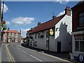
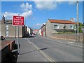
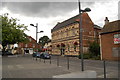
The lifestyle in DN17 4GL is shaped by its proximity to essential retail and rail services. Nearby amenities include Lincolnshire Co-operative Co, Tesco Crowle, and Co-op Petrol, providing basic shopping and fuel needs within easy reach. While the retail options are limited to these practical outlets, they cater to daily necessities without requiring long trips. The area’s rail network, with stations like Crowle and Althorpe, connects residents to broader regional hubs, enhancing mobility for work or leisure. Parks and recreational spaces are not explicitly listed in the data, but the absence of protected natural areas suggests a focus on residential rather than leisurely environments. The character of daily life here is likely quiet and functional, with a strong emphasis on convenience and connectivity. For those valuing a self-contained lifestyle with minimal urban sprawl, DN17 4GL offers a balance of practicality and accessibility, though it may lack the cultural or entertainment amenities found in larger towns.
Amenities
Schools
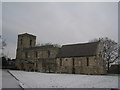
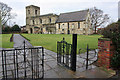
The schools nearest to DN17 4GL include Saint Norbert’s Catholic Primary School, which provides early education for younger children, and St Norbert’s Catholic Voluntary Academy, a secondary school with an Ofsted rating of ‘good’. This combination of primary and secondary education ensures families have access to a cohesive educational pathway without needing to travel far. The presence of a voluntary academy suggests a focus on faith-based values, which may align with the area’s demographic profile. With both schools within practical reach, parents can avoid long commutes, a key consideration for working families. The good Ofsted rating for the academy indicates a reliable standard of teaching, though specific performance metrics are not detailed. For those prioritising education quality and convenience, DN17 4GL offers a solid foundation, though the limited number of schools means no alternative options are available.
| Rank | School | Type | Entry gender | Ages |
|---|
Explore more schools in this area
Go to Schools tabDemographics
The population of DN17 4GL is predominantly adults aged 30–64, with a median age of 47. This suggests a mature, settled community, likely with strong family ties and long-term residency. Home ownership is high at 81%, indicating stability and a preference for private housing over rental properties. The area is almost entirely composed of houses, reflecting a suburban or semi-rural character rather than high-density living. The predominant ethnic group is White, though specific diversity figures are not provided. With 452 residents per square kilometre, the density is moderate, balancing privacy with proximity to services. The age profile implies a low demand for childcare or student housing, though the presence of two schools nearby may serve local needs. The lack of explicit deprivation data means quality of life is inferred from factors like safety and connectivity. Overall, DN17 4GL appears to cater to middle-aged households seeking a quiet, stable environment with minimal urban pressures.
Household Size
Accommodation Type
Tenure
Ethnic Group
Religion
Household Composition
Age
Household Deprivation
NS-SEC
Explore more demographic insights in this area
Go to Demographics tabPlanning
Planning Constraints
- Flood RiskPremium
- Ramsar Wetland SitesPremium
- Area of Outstanding Natural BeautyPremium
- Protected Nature ReservePremium
- Protected WoodlandPremium