Area Overview for DN17 3LH
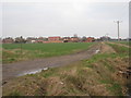
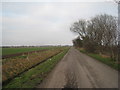
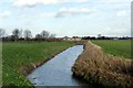
Photos of DN17 3LH
Area Information
DN17 3LH is a small, tightly knit residential cluster in England, covering 6,710 square metres and home to 1,942 residents. The area’s compact size fosters a close-knit community, with a population density of 88 people per square kilometre. Most residents are adults aged 30–64, reflecting a mature demographic with a median age of 47. This suggests a stable, long-term population, likely centred around families and professionals. The area’s small footprint means daily life is characterised by proximity to local amenities, schools, and transport links. While it lacks sprawling urban infrastructure, its size ensures a quiet, manageable environment. The high home ownership rate of 76% indicates a community of established residents, many of whom have lived in the area for years. For buyers, this offers a chance to settle into a familiar, low-density neighbourhood with a distinct local identity, though its limited size means growth is constrained.
- Area Type
- Postcode
- Area Size
- 6710 m²
- Population
- 1942
- Population Density
- 88 people/km²
The property market in DN17 3LH is dominated by owner-occupied homes, with 76% of residents owning their properties. This high home ownership rate suggests a stable, long-term community with limited rental activity. The accommodation type is primarily houses, reflecting the area’s low-density, suburban layout. As a small postcode area, the housing stock is limited, meaning buyers must consider the immediate surroundings for additional options. The focus on houses rather than flats or apartments indicates a preference for private, spacious living. For buyers, this means a market skewed towards established properties rather than new developments. The compact size of DN17 3LH also means that property values may be influenced by proximity to local amenities, schools, and transport links. Potential buyers should note the limited availability of new builds, which could affect both competition and price trends.
House Prices in DN17 3LH
Showing 12 properties
| Address | Type | Beds | Baths | Last Sale Price | Last Sale Date | |
|---|---|---|---|---|---|---|
| 8 Park View Terrace, West Butterwick, DN17 3LH | Semi-detached | 3 | 2 | £115,000 | Jan 2024 | |
| 24 Park View Terrace, West Butterwick, DN17 3LH | Semi-detached | 3 | 2 | £159,950 | Apr 2018 | |
| 22 Park View Terrace, West Butterwick, DN17 3LH | Semi-detached | - | - | £95,000 | Dec 2012 | |
| 2 Park View Terrace, West Butterwick, DN17 3LH | Retail | 3 | 2 | £92,500 | Aug 2005 | |
| 10 Park View Terrace, West Butterwick, DN17 3LH | Semi-detached | - | - | £36,000 | Jul 1997 | |
| 20 Park View Terrace, West Butterwick, DN17 3LH | house | 3 | - | £33,000 | Feb 1996 | |
| 6 Park View Terrace, West Butterwick, DN17 3LH | house | - | - | - | - | |
| 4 Park View Terrace, West Butterwick, DN17 3LH | Semi-detached | - | - | - | - | |
| 16 Park View Terrace, West Butterwick, DN17 3LH | Semi-detached | - | - | - | - | |
| 12 Park View Terrace, West Butterwick, DN17 3LH | house | - | - | - | - |
Energy Efficiency in DN17 3LH
Daily life in DN17 3LH is shaped by its proximity to practical amenities. Retail options include Co-op Mowbray, Asda Scunthorpe, and Tesco Lichfield, providing access to groceries, household goods, and other essentials. These stores are within easy reach, reducing the need for long commutes. The three nearby railway stations—Althorpe, Crowle, and Scunthorpe—offer connections to broader transport networks, enabling travel to urban centres or other regional hubs. While the area lacks detailed information on parks or leisure facilities, its compact size ensures a sense of convenience. The presence of multiple retail outlets and transport links suggests a lifestyle prioritising accessibility and practicality. Residents benefit from a balance between local services and the ability to travel further afield, making it suitable for those who value both independence and community.
Amenities
Schools
Residents of DN17 3LH have access to several primary schools, including West Butterwick C of E Primary School, St Martin’s CofE Primary School, and their associated academies, West Butterwick C of E Primary Academy and St Martin’s CofE Primary Academy. These institutions cater to younger children, providing multiple options for families. The presence of both traditional and academy schools suggests a range of educational approaches, though specific Ofsted ratings are not available. The concentration of primary schools within the area indicates a focus on local education, which is crucial for families with young children. The proximity of these schools to homes reduces commuting time, enhancing convenience. However, the lack of secondary school data means parents may need to look beyond DN17 3LH for comprehensive education.
| Rank | School | Type | Entry gender | Ages |
|---|
Explore more schools in this area
Go to Schools tabDemographics
The population of DN17 3LH is predominantly adults aged 30–64, with a median age of 47. This suggests a mature, settled community with fewer young families or retirees compared to other areas. Home ownership is high at 76%, indicating a preference for long-term residency over rental properties. The accommodation type is primarily houses, which aligns with the area’s low density and suburban character. The predominant ethnic group is White, though no specific data on diversity or deprivation is provided. The population density of 88 people per square kilometre is relatively low, contributing to a spacious, less congested living environment. This demographic profile implies a community focused on stability, with residents likely prioritising property ownership and family-oriented living. The absence of significant rental stock suggests limited turnover, reinforcing the area’s established nature.
Household Size
Accommodation Type
Tenure
Ethnic Group
Religion
Household Composition
Age
Household Deprivation
NS-SEC
Explore more demographic insights in this area
Go to Demographics tabPlanning
Planning Constraints
- Flood RiskPremium
- Ramsar Wetland SitesPremium
- Area of Outstanding Natural BeautyPremium
- Protected Nature ReservePremium
- Protected WoodlandPremium