Area Overview for DN17 3JJ
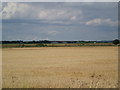
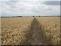
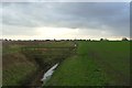
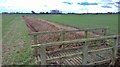
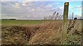
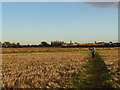
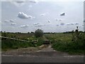
Photos of DN17 3JJ
Area Information
DN17 3JJ is a small, tightly knit residential area in England, covering just 9.8 hectares and home to 1942 residents. With a population density of 88 people per square kilometre, it feels intimate rather than crowded. The area is defined by its compact size and the presence of family-oriented housing, reflecting the demographic profile of adults aged 30–64, who make up the largest age group. This is a place where homeownership is strong, with 76% of residents owning their homes, suggesting a stable, long-term community. Daily life here is shaped by proximity to essential services, including three railway stations and five retail outlets, offering convenience for both errands and travel. While the area lacks natural landmarks or protected sites, its accessibility to nearby towns via rail and its robust broadband connectivity make it appealing for those prioritising practicality over scenic landscapes. The presence of multiple primary schools underscores its appeal to families, though the small size means the community is not expansive. For buyers seeking a quiet, manageable area with clear amenities, DN17 3JJ presents a focused, functional option.
- Area Type
- Postcode
- Area Size
- 9.8 hectares
- Population
- 1942
- Population Density
- 88 people/km²
DN17 3JJ is predominantly an owner-occupied area, with 76% of residents owning their homes. The housing stock is almost exclusively composed of houses, which is unusual for a small postcode area but aligns with the low population density of 88 people per square kilometre. This suggests a focus on single-family residences rather than apartments or shared housing. The compact size of the area means the property market is limited in scope, with few options available within the postcode itself. Buyers should consider the surrounding regions for broader choices, though proximity to rail links and retail hubs may influence property values. The dominance of owner-occupied homes indicates a stable market, but the small size could mean limited competition for buyers. Those seeking a traditional, private home in a low-density setting may find DN17 3JJ suitable, though the lack of rental properties means the area is less attractive to those prioritising flexibility.
House Prices in DN17 3JJ
Showing 5 properties
| Address | Type | Beds | Baths | Last Sale Price | Last Sale Date | |
|---|---|---|---|---|---|---|
| 9 Paddock Lane, West Butterwick, DN17 3JJ | Detached | 3 | 1 | £295,000 | Mar 2025 | |
| 7 Paddock Lane, West Butterwick, DN17 3JJ | house | - | - | £165,000 | Mar 2016 | |
| 3 Paddock Lane, West Butterwick, DN17 3JJ | Detached | - | - | £75,000 | Mar 2002 | |
| 1 Paddock Lane, West Butterwick, DN17 3JJ | Detached | - | - | - | - | |
| 5 Paddock Lane, West Butterwick, DN17 3JJ | Semi-detached | - | - | - | - |
Energy Efficiency in DN17 3JJ
Living in DN17 3JJ offers access to a modest selection of retail outlets, including Asda Scunthorpe, Co-op Mowbray, and Tesco Lichfield, all within practical reach. These stores provide essential shopping options for groceries, household items, and daily necessities. The area’s rail connections to Althorpe, Crowle, and Scunthorpe stations allow residents to travel easily to larger towns for more extensive shopping, dining, or leisure activities. While the data does not mention parks or recreational spaces, the presence of multiple retail outlets and rail links suggests a lifestyle focused on convenience and accessibility. The small size of the area means social interactions are likely to be localised, with community ties strengthening through shared access to nearby amenities. For those prioritising practicality over expansive leisure options, DN17 3JJ’s lifestyle is functional, with services tailored to meet everyday needs.
Amenities
Schools
Residents of DN17 3JJ have access to multiple primary schools, including West Butterwick C of E Primary School, St Martin’s CofE Primary School, and their academy counterparts. These institutions cater to young families, offering a range of educational options. The presence of four primary schools within the area suggests a strong emphasis on early education, though no secondary schools are listed in the data. This could mean families need to travel to nearby towns for secondary education, which is a practical consideration for parents. The repetition of school names with “Academy” in their titles indicates some institutions may have converted to academy status, potentially affecting funding or governance structures. While the data does not provide Ofsted ratings, the number of schools available reflects a focus on primary education, which is a key factor for families prioritising schooling in their decision to move.
| Rank | School | Type | Entry gender | Ages |
|---|
Explore more schools in this area
Go to Schools tabDemographics
The population of DN17 3JJ is predominantly adults aged 30–64, with a median age of 47. This suggests a mature, settled community, likely with established careers and families. Homeownership is high at 76%, indicating a preference for long-term residency over rental properties. The area is composed almost entirely of houses, reflecting a traditional, low-density housing stock. The predominant ethnic group is White, with no data provided on other demographics. The population density of 88 people per square kilometre is low, contributing to a sense of space and privacy. This profile aligns with a community that values stability and proximity to essential services. The absence of specific data on deprivation or diversity means the area’s social dynamics remain largely unexplored in public records, but the high homeownership rate and age range suggest a cohesive, middle-aged population with shared priorities.
Household Size
Accommodation Type
Tenure
Ethnic Group
Religion
Household Composition
Age
Household Deprivation
NS-SEC
Explore more demographic insights in this area
Go to Demographics tabPlanning
Planning Constraints
- Flood RiskPremium
- Ramsar Wetland SitesPremium
- Area of Outstanding Natural BeautyPremium
- Protected Nature ReservePremium
- Protected WoodlandPremium