Area Overview for DN17 3LE
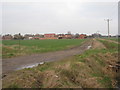
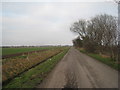
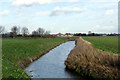
Photos of DN17 3LE
Area Information
DN17 3LE is a small residential postcode area in England, covering 9,303 square metres and home to 1,942 residents. With a population density of 88 people per square kilometre, this is a tightly knit community where daily life revolves around local amenities and nearby towns. The area is characterised by a mature demographic, with a median age of 47 and a majority of residents aged 30–64. Home ownership is high at 76%, with most properties being houses rather than flats. This suggests a stable, long-term population with a focus on family living. The proximity to multiple schools, rail stations, and retail outlets makes it practical for everyday needs. While the area is small, its strategic location near Scunthorpe and surrounding villages offers access to broader services. For those considering living in DN17 3LE, the balance of quiet residential living and nearby connectivity is a key draw, though flood risk remains a critical consideration.
- Area Type
- Postcode
- Area Size
- 9303 m²
- Population
- 1942
- Population Density
- 88 people/km²
The property market in DN17 3LE is dominated by owner-occupied homes, with 76% of properties owned by residents rather than rented. This indicates a community with a strong emphasis on long-term investment in housing. The accommodation type is primarily houses, suggesting a lack of high-density development and a focus on single-family homes. Given the area’s small size, the housing stock is limited, which may mean fewer options for buyers but potentially more established properties. The high home ownership rate also implies a stable market with less turnover. For buyers, this means a focus on purchasing rather than renting, though the proximity to Scunthorpe and surrounding areas could provide additional options. The mix of houses and the absence of flats suggests a demographic that prioritises space and privacy.
House Prices in DN17 3LE
Showing 10 properties
| Address | Type | Beds | Baths | Last Sale Price | Last Sale Date | |
|---|---|---|---|---|---|---|
| 52 West Street, West Butterwick, DN17 3LE | Bungalow | 3 | 1 | £260,000 | Mar 2024 | |
| 44 West Street, West Butterwick, DN17 3LE | Retail | 3 | 1 | £230,000 | May 2022 | |
| 46 West Street, West Butterwick, DN17 3LE | Bungalow | - | - | £127,000 | Feb 2021 | |
| 48 West Street, West Butterwick, DN17 3LE | Bungalow | 5 | 2 | £190,000 | May 2020 | |
| 50 West Street, West Butterwick, DN17 3LE | Bungalow | 3 | 1 | £115,000 | Mar 2018 | |
| 60 West Street, West Butterwick, DN17 3LE | Bungalow | - | - | - | - | |
| 58 West Street, West Butterwick, DN17 3LE | Bungalow | - | - | - | - | |
| 54 West Street, West Butterwick, DN17 3LE | Detached | - | - | - | - | |
| 62 West Street, West Butterwick, DN17 3LE | Bungalow | - | - | - | - | |
| 56 West Street, West Butterwick, DN17 3LE | Semi-detached | - | - | - | - |
Energy Efficiency in DN17 3LE
Living in DN17 3LE offers access to essential amenities within practical reach. Retail options include Asda Scunthorpe, Co-op Mowbray, and Tesco Lichfield, providing grocery and daily shopping needs. The three nearby railway stations—Althorpe, Crowle, and Scunthorpe—enhance connectivity, enabling easy travel to surrounding areas. While the data does not mention parks or leisure facilities, the proximity to rail and retail suggests a practical lifestyle focused on convenience. The presence of multiple primary schools adds to the area’s appeal for families. The small size of DN17 3LE means amenities are concentrated, reducing the need for long commutes. However, buyers should consider whether local leisure options meet personal preferences, as specific details on parks or recreational facilities are not provided.
Amenities
Schools
Residents of DN17 3LE have access to multiple primary schools within the area, including West Butterwick C of E Primary School, St Martin’s CofE Primary School, and their academy equivalents. These institutions cater to younger families, offering a range of educational options. The presence of two distinct schools with similar names suggests a focus on local church-affiliated education, though specific Ofsted ratings are not provided. The availability of multiple primary schools within walking distance or short drives is a significant advantage for families, reducing the need for long commutes. The mix of traditional and academy-style schools may indicate a blend of established and modern teaching approaches. However, data on secondary schools or higher education facilities is absent, so prospective buyers should investigate further for comprehensive schooling needs.
| Rank | School | Type | Entry gender | Ages |
|---|
Explore more schools in this area
Go to Schools tabDemographics
The community in DN17 3LE is predominantly composed of adults aged 30–64, reflecting a mature population with a median age of 47. Home ownership is high, with 76% of residents living in owner-occupied properties. The accommodation type is primarily houses, indicating a residential area with fewer rental properties. The predominant ethnic group is White, though specific data on diversity or deprivation is not provided. The age profile suggests a community with established families and professionals, likely contributing to a stable local economy. With a population of 1,942, the area is small enough to foster a close-knit environment but large enough to support essential services. The demographic makeup aligns with a suburban setting where long-term residency is common, and community ties are likely strong.
Household Size
Accommodation Type
Tenure
Ethnic Group
Religion
Household Composition
Age
Household Deprivation
NS-SEC
Explore more demographic insights in this area
Go to Demographics tabPlanning
Planning Constraints
- Flood RiskPremium
- Ramsar Wetland SitesPremium
- Area of Outstanding Natural BeautyPremium
- Protected Nature ReservePremium
- Protected WoodlandPremium