Area Overview for BD7 3EY
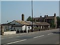
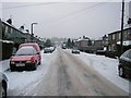
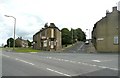
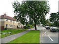
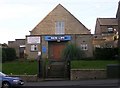
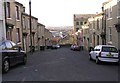
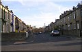
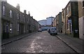
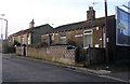
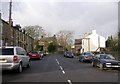
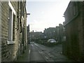
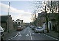
Photos of BD7 3EY
Area Information
BD7 3EY is a compact postcode area in the heart of Bradford, England, encompassing a small residential cluster within the city’s central boundaries. With a population of 1,683 spread across 5,942 square metres, the area is densely populated, reflecting the urban character of the broader Bradford region. This postcode falls within the City Ward, an electoral area defined by its proximity to the city centre and inner ring road. Daily life here is shaped by proximity to retail, transport, and historical landmarks. Residents benefit from easy access to major retailers like Tesco Bradford and rail networks including Bradford Interchange and Forster Square stations, which connect to wider regional routes. The area’s high population density means a tight-knit community, though the predominantly Asian population and median age of 22 suggest a mix of long-term residents and younger households. While the area lacks natural constraints like protected woodlands or AONB designations, its urban setting offers convenience over isolation. For buyers, BD7 3EY represents a compact, centrally located option with immediate access to city amenities, though its small size means limited housing stock and a focus on existing properties rather than new developments.
- Area Type
- Postcode
- Area Size
- 5942 m²
- Population
- Not available
- Population Density
- Not available
The property market in BD7 3EY is characterised by a 38% home ownership rate, meaning most properties are rented rather than owner-occupied. This suggests a rental-dominated market, likely influenced by the area’s compact size and high population density. The predominant accommodation type is houses, which is notable in a densely populated urban postcode, potentially indicating older, family-oriented housing stock or properties with larger layouts. For buyers, this small area offers limited housing options, with a focus on existing homes rather than new developments. The high population density may also mean competition for available properties, particularly for those seeking larger homes. Given the area’s proximity to retail and transport hubs, it appeals to those prioritising convenience over space. However, the rental market’s dominance could make homeownership challenging, requiring buyers to consider long-term investment potential or alternative areas for expansion.
House Prices in BD7 3EY
Showing 10 properties
| Address | Type | Beds | Baths | Last Sale Price | Last Sale Date | |
|---|---|---|---|---|---|---|
| 25 Arctic Parade, Bradford, BD7 3EY | Terraced | 2 | 1 | £38,000 | Oct 2024 | |
| 27 Arctic Parade, Bradford, BD7 3EY | Terraced | 1 | 1 | £48,750 | Mar 2022 | |
| 12 Arctic Parade, Bradford, BD7 3EY | house | - | - | £66,000 | Mar 2019 | |
| 21 Arctic Parade, Bradford, BD7 3EY | Terraced | 2 | 1 | £53,000 | Apr 2011 | |
| 33A Arctic Parade, Bradford, BD7 3EY | Flat | - | - | £56,000 | Oct 2010 | |
| 23 Arctic Parade, Bradford, BD7 3EY | house | - | - | £59,000 | May 2006 | |
| 29 Arctic Parade, Bradford, BD7 3EY | house | - | - | £32,000 | Sep 2004 | |
| 14 Arctic Parade, Bradford, BD7 3EY | house | - | - | £13,000 | May 1996 | |
| Ali Baba Carpets, Lower Ground Floor, Wesley Place Buildings, Arctic Parade, Bradford, BD7 3EY | shop | - | - | - | - | |
| 31A Arctic Parade, Bradford, BD7 3EY | Flat | - | - | - | - |
Energy Efficiency in BD7 3EY
Living in BD7 3EY offers immediate access to essential amenities, including five retail outlets such as Tesco Bradford, Aldi Clayton, and Asda Little, ensuring convenience for shopping and daily needs. The area’s rail network, with five nearby stations like Bradford Interchange and Forster Square, facilitates easy travel to surrounding areas, making it ideal for commuters. While the postcode lacks green spaces or leisure facilities, its urban setting places residents close to Bradford’s city centre, historic sites, and cultural attractions. The compact nature of the area means a walkable environment, reducing the need for cars. However, the absence of parks or recreational spaces could be a drawback for those seeking outdoor activities. The presence of multiple retail and transport hubs contributes to a dynamic, practical lifestyle, though the density of the area may limit personal space or privacy.
Amenities
Schools
| Rank | School | Type | Entry gender | Ages |
|---|
Explore more schools in this area
Go to Schools tabDemographics
The community in BD7 3EY is defined by a median age of 22, though the most common age range among residents is 30–64 years. This suggests a population skewed towards working-age adults, potentially including families and professionals. Home ownership rates here are 38%, indicating that the majority of properties are rented, which aligns with the area’s high population density and compact size. The predominant accommodation type is houses, which is unusual for a densely populated urban postcode but may reflect older housing stock or specific planning. The Asian_total ethnic group is the largest demographic, contributing to the area’s cultural character. With a population density of 283,246 people per square kilometre, living conditions are closely packed, which may influence community dynamics and access to shared spaces. While specific deprivation data is not provided, the high proportion of renters and younger residents could imply a mix of economic profiles, with potential challenges in housing affordability or long-term stability.
Household Size
Accommodation Type
Tenure
Ethnic Group
Religion
Household Composition
Age
Household Deprivation
NS-SEC
Explore more demographic insights in this area
Go to Demographics tabPlanning
Planning Constraints
- Flood RiskPremium
- Ramsar Wetland SitesPremium
- Area of Outstanding Natural BeautyPremium
- Protected Nature ReservePremium
- Protected WoodlandPremium