Area Overview for BD7 3EX
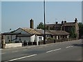
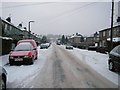
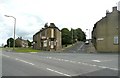
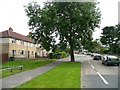
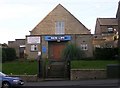
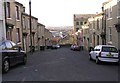
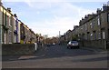
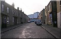
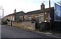
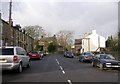
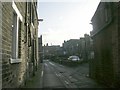
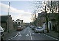
Photos of BD7 3EX
Area Information
Living in BD7 3EX means inhabiting a compact, densely populated postcode nestled within the historic Great Horton ward of Bradford. This area, spanning 4,769 square metres, is home to 1,798 residents, creating a population density of 377,000 people per square kilometre. Its proximity to Bradford city centre—just 2.5 miles away—offers easy access to urban amenities while retaining a distinct character shaped by its conservation area status. The ward preserves 17th- to 19th-century architecture, including listed buildings like Hall’s House and the Old Bell Chapel, alongside 18th-century workers’ housing. Daily life here blends urban convenience with historic charm, supported by nearby schools, retail, and rail links. The area’s compact size fosters a tightly knit community, though its high density may feel cramped for some. For those seeking a mix of heritage and modernity, BD7 3EX offers a unique slice of Bradford’s evolving landscape, where industrial past meets contemporary living.
- Area Type
- Postcode
- Area Size
- 4769 m²
- Population
- 1798
- Population Density
- 6300 people/km²
The property market in BD7 3EX is dominated by houses, reflecting a preference for detached or semi-detached homes in a residential cluster. With 40% home ownership, the area is not heavily reliant on rental properties, though the small size of the postcode—just 4,769 square metres—means the housing stock is limited. This scarcity could drive competition among buyers, particularly for properties in the conservation area, which may hold historical or architectural value. The predominance of houses over flats suggests a market appealing to families or those seeking larger living spaces. However, the high population density raises questions about the availability of land for new developments. For buyers, this area’s compact size and historic character may be assets, but the lack of extensive housing options could limit choices for those seeking multiple properties.
House Prices in BD7 3EX
Showing 19 properties
| Address | Type | Beds | Baths | Last Sale Price | Last Sale Date | |
|---|---|---|---|---|---|---|
| 10 Bakes Street, Bradford, BD7 3EX | Terraced | 3 | 1 | £70,000 | Jul 2004 | |
| 9 Bakes Street, Bradford, BD7 3EX | Flat | - | - | - | - | |
| 23 Bakes Street, Bradford, BD7 3EX | Flat | - | - | - | - | |
| 6 Bakes Street, Bradford, BD7 3EX | house | - | - | - | - | |
| 17 Bakes Street, Bradford, BD7 3EX | Flat | - | - | - | - | |
| 19 Bakes Street, Bradford, BD7 3EX | Flat | - | - | - | - | |
| 7 Bakes Street, Bradford, BD7 3EX | Flat | - | - | - | - | |
| 12 Bakes Street, Bradford, BD7 3EX | house | - | - | - | - | |
| 21 Bakes Street, Bradford, BD7 3EX | Flat | - | - | - | - | |
| 1 Bakes Street, Bradford, BD7 3EX | Flat | - | - | - | - |
Energy Efficiency in BD7 3EX
The lifestyle in BD7 3EX is shaped by its proximity to retail hubs like Tesco Bradford, Aldi Clayton, and Asda Little, offering everyday shopping convenience. The area’s rail links, including Bradford Interchange and Forster Square stations, provide easy access to Bradford’s wider transport network. For leisure, Horton Park—a public park opened in 1878—offers green space for recreation, though its size and amenities are not detailed in the data. The conservation area’s historic buildings, such as Hall’s House and the Old Bell Chapel, add cultural value. However, the absence of specific details on dining or entertainment venues means the full range of lifestyle options is unclear. The area’s compact size ensures amenities are within walking distance, but the high population density may affect the availability of private outdoor space. For residents, the blend of practicality and heritage offers a functional yet characterful environment.
Amenities
Schools
BD7 3EX is served by several primary schools, including Brackenhill Primary School, which holds a ‘good’ Ofsted rating, and St Oswald’s CofE Primary School, which has a ‘satisfactory’ rating. Great Horton Middle School and St Oswald’s Church of England Primary Academy also cater to primary education, while Ummid Independent School provides special educational needs support. The mix of state and independent schools offers families flexibility, though the ‘satisfactory’ rating at St Oswald’s indicates room for improvement. The presence of a special school like Ummid highlights the area’s commitment to inclusive education. However, the absence of secondary schools nearby means students may need to commute to other parts of Bradford. For parents prioritising school quality, Brackenhill’s ‘good’ rating is a notable advantage, though the overall range of options is limited by the area’s small size.
| Rank | School | Type | Entry gender | Ages |
|---|
Explore more schools in this area
Go to Schools tabDemographics
The population of BD7 3EX skews towards adults aged 30–64, with a median age of 47. This suggests a community of established professionals and families, though the 40% home ownership rate indicates a significant proportion of residents rent. The area’s predominant ethnic group is Asian, reflecting broader demographic trends in Bradford. The high population density—377,000 people per square kilometre—means limited space per household, which may impact living conditions. With 40% of homes owned by residents, the area is not dominated by rental properties but still sees a reliance on private landlords. The absence of specific deprivation data means it is unclear how economic challenges affect quality of life, though the presence of schools and amenities suggests some level of investment in community infrastructure.
Household Size
Accommodation Type
Tenure
Ethnic Group
Religion
Household Composition
Age
Household Deprivation
NS-SEC
Explore more demographic insights in this area
Go to Demographics tabPlanning
Planning Constraints
- Flood RiskPremium
- Ramsar Wetland SitesPremium
- Area of Outstanding Natural BeautyPremium
- Protected Nature ReservePremium
- Protected WoodlandPremium