Area Overview for BD7 3BZ
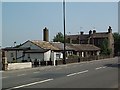
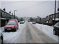
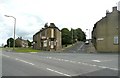
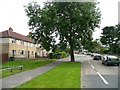
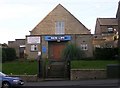
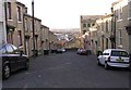
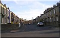
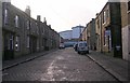
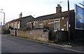
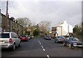
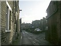
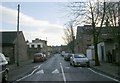
Photos of BD7 3BZ
Area Information
Living in BD7 3BZ means inhabiting a tightly packed residential cluster at the heart of Bradford’s urban fabric. The area covers just 3,015 square metres, yet it is home to 2,184 people, translating to a population density of 724,378 per square kilometre — a stark reflection of its compact, city-centre location. This postcode falls within the City Ward, a historic electoral boundary encompassing Bradford’s inner ring road. Daily life here is defined by proximity to retail, transport, and the city’s cultural core. The area’s small footprint means amenities are within easy reach, from supermarkets like Tesco Bradford to nearby rail stations. With a median age of 22, the community is young, yet the most common age range is 30–64, suggesting a blend of long-term residents and newer arrivals. The predominant ethnic group is Asian, shaping the area’s cultural character. For those seeking a central, connected location with a mix of urban energy and residential comfort, BD7 3BZ offers a distinct proposition.
- Area Type
- Postcode
- Area Size
- 3015 m²
- Population
- 2184
- Population Density
- 9794 people/km²
The property market in BD7 3BZ is characterised by a 52% home ownership rate, meaning nearly half of properties are owner-occupied, while the rest are likely to be in the rental market. The area is predominantly composed of houses, not flats, which may reflect a preference for family-friendly or more spacious living. Given the postcode’s small size and high population density, the housing stock is limited, and buyers should consider the immediate surrounding areas for more options. The compact nature of BD7 3BZ means properties are likely to be close to amenities, rail links, and the city centre, which could be a significant draw for those prioritising convenience. However, the high density may also mean competition for available homes. For buyers, this area suits those seeking a central, connected location with a mix of residential and urban features, though the limited size of the postcode may require a broader search for larger property selections.
House Prices in BD7 3BZ
Showing 8 properties
| Address | Type | Beds | Baths | Last Sale Price | Last Sale Date | |
|---|---|---|---|---|---|---|
| Mobile Media Bradford, Ground Floor Shop, 387 Great Horton Road, Bradford, BD7 3BZ | shop | - | - | - | - | |
| 389A Great Horton Road, Bradford, BD7 3BZ | Flat | - | - | - | - | |
| Assembly Building Rear Of, 353 Great Horton Road, Bradford, BD7 3BZ | Office | - | - | - | - | |
| Flat At, 381A Great Horton Road, Bradford, BD7 3BZ | Flat | - | - | - | - | |
| Mahmood Rizvi Accountancy Services Limited, 353A Great Horton Road, Bradford, BD7 3BZ | Office | - | - | - | - | |
| 385B Great Horton Road, Bradford, BD7 3BZ | Flat | - | - | - | - | |
| 387A Great Horton Road, Bradford, BD7 3BZ | Flat | 2 | 1 | - | - | |
| 385A Great Horton Road, Bradford, BD7 3BZ | Maisonette | 2 | 1 | - | - |
Energy Efficiency in BD7 3BZ
Life in BD7 3BZ is shaped by its proximity to retail and transport hubs. Within practical reach are five retail outlets, including major supermarkets like Tesco Bradford, Asda Little, and Aldi Clayton, ensuring everyday shopping needs are met without long journeys. The area’s rail network, with five stations including Bradford Interchange and Bradford Foster Square, provides easy access to the city’s cultural and commercial centres. While the postcode itself is small, its location within Bradford’s inner ring road means residents are near the city’s historic and modern amenities. The compact nature of the area means daily life is efficient, with amenities clustered closely. However, the absence of named parks or leisure facilities in the data suggests that outdoor recreation may require travel beyond the immediate postcode. For those valuing convenience and urban accessibility, BD7 3BZ offers a lifestyle defined by proximity and practicality.
Amenities
Schools
| Rank | School | Type | Entry gender | Ages |
|---|
Explore more schools in this area
Go to Schools tabDemographics
BD7 3BZ has a median age of 22, but the most common age range among residents is 30–64 years, indicating a community where younger people coexist with older, more established households. Home ownership stands at 52%, with the remaining 48% likely to be renters, suggesting a mix of long-term residents and those in transient housing. The area is predominantly composed of houses, not flats, which may appeal to families or those seeking more space. The predominant ethnic group is Asian, a figure that underscores the area’s cultural diversity. With a population density of 724,378 per square kilometre, the area is intensely populated, which can mean tightly packed living but also efficient access to services. This density, combined with the age profile, suggests a community that balances youthful dynamism with the stability of middle-aged households.
Household Size
Accommodation Type
Tenure
Ethnic Group
Religion
Household Composition
Age
Household Deprivation
NS-SEC
Explore more demographic insights in this area
Go to Demographics tabPlanning
Planning Constraints
- Flood RiskPremium
- Ramsar Wetland SitesPremium
- Area of Outstanding Natural BeautyPremium
- Protected Nature ReservePremium
- Protected WoodlandPremium