Area Overview for BD7 3BU
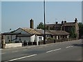
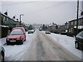
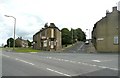
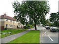
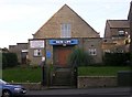
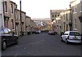
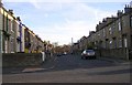
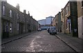
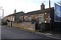
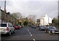
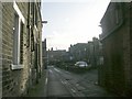
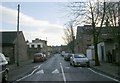
Photos of BD7 3BU
Area Information
Living in BD7 3BU means being part of a densely populated, compact residential cluster within the heart of Bradford’s urban core. The area covers 996 square metres and is home to 2,184 residents, making it one of the most densely populated parts of the city. Situated within the City Ward, it falls under the City of Bradford Metropolitan District Council and is defined by its central location, bounded by the inner ring road. This postcode area is a microcosm of Bradford’s character, with a mix of older housing stock and modern infrastructure. The proximity to key transport hubs, including multiple railway stations, and access to retail amenities like Tesco and Asda make daily life convenient. However, the small size of the area means that residents are likely to know their neighbours, creating a tight-knit community. The area’s demographics suggest a working-age population, with a median age of 22 and a majority of residents aged 30–64, indicating a balance between young professionals and established families. Its location offers easy access to the city’s cultural and commercial centres, though the density may limit green spaces. For buyers, BD7 3BU represents a blend of urban convenience and proximity to essential services, though the compact nature of the area demands consideration of local constraints.
- Area Type
- Postcode
- Area Size
- 996 m²
- Population
- 2184
- Population Density
- 9794 people/km²
The property market in BD7 3BU is characterised by a 52% home ownership rate, with houses forming the predominant accommodation type. This suggests a focus on owner-occupied properties, though the remaining 48% of the housing stock is likely rental or other tenures. The concentration of houses in a high-density area is notable, as it contrasts with the typical urban trend of apartments or flats. This may indicate a mix of family homes and larger units, catering to both established residents and those seeking space within the city. Given the small area size of 996 m², the housing stock is limited, which could mean competition for properties and limited scope for new developments. Buyers should consider the proximity to amenities and transport links as key selling points, though the compact nature of the area may restrict options for those seeking larger plots or specific features. The market’s character is defined by its urban setting, with properties likely prioritising convenience over expansive outdoor space.
House Prices in BD7 3BU
Showing 3 properties
| Address | Type | Beds | Baths | Last Sale Price | Last Sale Date | |
|---|---|---|---|---|---|---|
| Flat At, 347 Great Horton Road, Bradford, BD7 3BU | Flat | 4 | 2 | - | - | |
| First And Second Floors, 349-351 Great Horton Road, Bradford, BD7 3BU | Retail | - | - | - | - | |
| 1 Cambridge Street, Great Horton, Bradford, BD7 3BU | Flat | - | - | - | - |
Energy Efficiency in BD7 3BU
Life in BD7 3BU is shaped by its proximity to essential amenities, with retail options like Tesco Bradford, Asda Little, and Aldi Clayton within practical reach. These stores provide everyday convenience, from groceries to household goods, reducing the need for long journeys. The area’s rail network is a key feature, with five nearby stations—including Bradford Interchange and Bradford Forster Square—offering direct links to the city’s transport arteries. These stations facilitate commuting to workplaces, educational institutions, or leisure destinations. While the data does not specify parks or leisure facilities, the area’s density suggests that public spaces may be limited, with residents relying on nearby urban parks or community centres. The presence of multiple retail outlets and transport hubs creates a functional, if compact, lifestyle. For those prioritising convenience over expansive green spaces, BD7 3BU offers a self-contained environment where daily needs are met within walking or short-vehicle distance.
Amenities
Schools
| Rank | School | Type | Entry gender | Ages |
|---|
Explore more schools in this area
Go to Schools tabDemographics
The community in BD7 3BU is predominantly composed of adults aged 30–64, with a median age of 22, suggesting a dynamic mix of younger and middle-aged residents. Home ownership stands at 52%, indicating a majority of owner-occupied properties, though the remaining 48% likely reflects rental or other tenures. The accommodation type is primarily houses, which is unusual for a high-density urban area, hinting at a focus on family homes or larger units. The predominant ethnic group is Asian_total, reflecting Bradford’s broader demographic profile. This composition shapes the area’s social fabric, with a working-age population likely driving local economic activity. The high population density—2,193,142 people per square kilometre—means shared spaces and proximity to neighbours, which can foster a sense of community but may also strain local services. The absence of specific deprivation data in the provided information means that quality of life factors like access to healthcare or education are not quantified here, though the presence of retail and transport links suggests basic needs are met.
Household Size
Accommodation Type
Tenure
Ethnic Group
Religion
Household Composition
Age
Household Deprivation
NS-SEC
Explore more demographic insights in this area
Go to Demographics tabPlanning
Planning Constraints
- Flood RiskPremium
- Ramsar Wetland SitesPremium
- Area of Outstanding Natural BeautyPremium
- Protected Nature ReservePremium
- Protected WoodlandPremium