Area Overview for BD6 3WE
Photos of BD6 3WE
Area Information
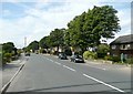
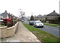
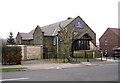
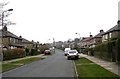
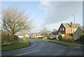
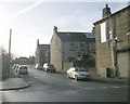
BD6 3WE is a compact residential postcode nestled in the historic village of Queensbury, part of the City of Bradford district in West Yorkshire. Covering just 3,740 square metres, this area is densely populated, with 2,168 residents living at a density of over 579,000 people per square kilometre. Its small size reflects its character as a tight-knit community, shaped by its origins as a resting point on the 1740 Bradford-Halifax turnpike road. Queensbury’s name derives from the Queenshead coaching inn, established in 1754, which later became the village’s namesake. Today, the area retains a quiet, residential charm, with homes predominantly occupied by homeowners. The median age of 47 suggests a mature population, with a strong presence of adults aged 30–64. Living here means proximity to historic sites like Holy Trinity Church and the Black Dyke Mills, while modern amenities such as local shops and rail stations provide everyday convenience. The area’s compact nature means residents are close to both rural landscapes and urban services, offering a blend of heritage and practicality.
- Area Type
- Postcode
- Area Size
- 3740 m²
- Population
- 2168
- Population Density
- 4984 people/km²
The property market in BD6 3WE is characterised by a high rate of home ownership (65%) and a focus on houses rather than flats or apartments. This suggests a community where homeownership is the norm, with properties likely to be family homes or long-term investments. The small area size means the housing stock is limited, potentially making the market competitive for buyers. With no data on rental properties, it is unclear how much of the market is occupied by tenants, but the high ownership rate implies a lower proportion of rental properties compared to other areas. The predominance of houses over other accommodation types aligns with the area’s traditional, residential character. For buyers, this means a focus on individual homes rather than larger developments, with potential for property value stability due to the area’s compact, established nature. However, the limited size of BD6 3WE may restrict availability, requiring buyers to consider nearby postcodes for more options.
House Prices in BD6 3WE
Showing 25 properties
| Address | Type | Beds | Baths | Last Sale Price | Last Sale Date | |
|---|---|---|---|---|---|---|
| 11 Chelker Close, Bradford, BD6 3WE | Semi-detached | 4 | 1 | £240,000 | Sep 2024 | |
| 7 Chelker Close, Bradford, BD6 3WE | house | - | - | £149,995 | Jul 2021 | |
| 9 Chelker Close, Bradford, BD6 3WE | Semi-detached | 3 | 1 | £159,995 | May 2021 | |
| 4 Chelker Close, Bradford, BD6 3WE | Semi-detached | 4 | 3 | £165,000 | Mar 2019 | |
| 2 Chelker Close, Bradford, BD6 3WE | house | 2 | 1 | £145,950 | Jan 2017 | |
| 5 Chelker Close, Bradford, BD6 3WE | house | - | - | £132,000 | Mar 2011 | |
| 6 Chelker Close, Bradford, BD6 3WE | house | - | - | £148,000 | Apr 2008 | |
| 19 Chelker Close, Bradford, BD6 3WE | Semi-detached | 5 | 3 | £165,000 | Aug 2007 | |
| 15 Chelker Close, Bradford, BD6 3WE | Semi-detached | 4 | 3 | £158,000 | Dec 2006 | |
| 8 Chelker Close, Bradford, BD6 3WE | house | - | - | £144,995 | Jun 2006 |
Energy Efficiency in BD6 3WE
Daily life in BD6 3WE is shaped by its proximity to retail and transport hubs. Local shops such as Heron Clayton, Aldi Clayton, and Lidl Shelf provide essential services, reducing the need for long trips. The area’s rail stations, including Low Moor and Bradford Interchange, offer easy access to Bradford’s commercial and cultural centres. While no parks or leisure facilities are listed, the nearby historic Black Dyke Mills and Queensbury Conservation Area suggest opportunities for walking or exploring heritage sites. The compact nature of the area means amenities are within practical reach, though larger leisure options may require travel to nearby towns. The mix of retail and transport links supports a convenient lifestyle, with a focus on local convenience over extensive urban facilities. The presence of schools and community institutions reinforces a family-friendly environment, though the absence of detailed leisure data means the area’s recreational offerings remain understated.
Amenities
Schools
Residents of BD6 3WE have access to a range of schools, including primary and special education institutions. Cooper Lane Primary School and Westwood Park Primary School serve younger children, while Mandale Middle School, despite its name, is listed as a primary school. High Trees School is a special needs institution, providing tailored support for students with specific requirements. Home Farm Primary School is noted for its ‘good’ Ofsted rating, indicating a high standard of education. This mix of school types ensures families have options for both general and specialist education. The presence of multiple primary schools suggests a focus on early education, with proximity to secondary schools potentially requiring a wider search. The availability of a special school highlights the area’s commitment to inclusive education, though no secondary schools are listed in the data.
| Rank | School | Type | Entry gender | Ages |
|---|
Explore more schools in this area
Go to Schools tabDemographics
The population of BD6 3WE is 2,168, with a median age of 47 years, indicating a mature demographic. The most common age range is adults aged 30–64, reflecting a stable, middle-aged community. Home ownership is high at 65%, with houses being the predominant accommodation type. This suggests a mix of long-term residents and families seeking established housing. The predominant ethnic group is White, though no specific data on diversity or deprivation is provided. The high home ownership rate implies a relatively stable housing market, with fewer renters compared to other areas. The age profile suggests a community focused on family life and long-term residency, with fewer young professionals or students. The absence of detailed diversity data means the area’s social composition remains largely unquantified, but the presence of primary schools and local amenities indicates a need for family-oriented services.
Household Size
Accommodation Type
Tenure
Ethnic Group
Religion
Household Composition
Age
Household Deprivation
NS-SEC
Explore more demographic insights in this area
Go to Demographics tabPlanning
Planning Constraints
- Flood RiskPremium
- Ramsar Wetland SitesPremium
- Area of Outstanding Natural BeautyPremium
- Protected Nature ReservePremium
- Protected WoodlandPremium