Area Overview for BD6 3WP
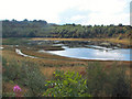
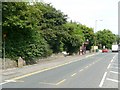
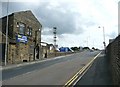
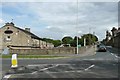
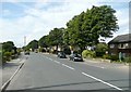
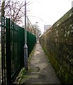
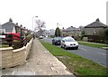
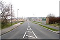
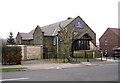
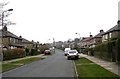
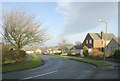
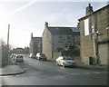
Photos of BD6 3WP
Area Information
Living in BD6 3WP means being part of a densely populated, small-scale residential cluster in West Yorkshire. The area covers 7,982 square metres and is home to 2,168 people, making it one of the most densely populated regions in England. Its history is rooted in the 18th-century Bradford-Halifax turnpike road, with the village named after the Queenshead coaching inn, later renamed Queensbury. Today, the area retains a quiet, residential character, with homes predominantly occupied by owners. Its proximity to Halifax and Boothtown offers easy access to larger towns, while the surrounding landscape includes historic sites like Black Dyke Mills and Holy Trinity Church. Daily life here balances local amenities with the convenience of nearby transport links, including railway stations within practical reach. The community’s age profile, skewed toward adults aged 30–64, suggests a stable, long-term population, with families and professionals coexisting in a compact, well-serviced environment.
- Area Type
- Postcode
- Area Size
- 7982 m²
- Population
- 2168
- Population Density
- 4984 people/km²
The property market in BD6 3WP is characterised by high home ownership (65%) and a predominance of houses over flats or apartments. This suggests a community of long-term residents rather than a transient rental market. The small area size and compact layout mean housing stock is limited, with properties likely to be older, reflecting the area’s 19th-century origins. The absence of major commercial developments or business parks indicates a focus on residential living rather than speculative investment. For buyers, this means competition for available homes, with limited scope for new builds. The proximity to railway stations and schools may enhance property value, but the area’s small size means buyers must consider immediate surroundings for additional options.
House Prices in BD6 3WP
Showing 35 properties
| Address | Type | Beds | Baths | Last Sale Price | Last Sale Date | |
|---|---|---|---|---|---|---|
| 41 Meldon Way, Bradford, BD6 3WP | Terraced | 4 | 2 | £168,500 | Aug 2025 | |
| 27 Meldon Way, Bradford, BD6 3WP | house | - | - | £180,000 | Sep 2024 | |
| 25 Meldon Way, Bradford, BD6 3WP | Semi-detached | 3 | 2 | £178,000 | Feb 2024 | |
| 9 Meldon Way, Bradford, BD6 3WP | Terraced | 3 | 1 | £173,000 | Jan 2024 | |
| 45 Meldon Way, Bradford, BD6 3WP | Semi-detached | 3 | 3 | £185,000 | Oct 2023 | |
| 37 Meldon Way, Bradford, BD6 3WP | house | 3 | 2 | £100,000 | Feb 2023 | |
| 61 Meldon Way, Bradford, BD6 3WP | Semi-detached | 3 | 3 | £155,000 | Nov 2022 | |
| 11 Meldon Way, Bradford, BD6 3WP | house | - | - | £120,000 | Sep 2022 | |
| 49 Meldon Way, Bradford, BD6 3WP | Semi-detached | 3 | 1 | £171,500 | Apr 2022 | |
| 65 Meldon Way, Bradford, BD6 3WP | Terraced | 3 | 2 | £181,000 | Dec 2021 |
Energy Efficiency in BD6 3WP
Residents of BD6 3WP have access to local retail options, including Lidl Shelf, Heron Clayton, and Aldi Clayton, offering everyday shopping needs. The nearby railway stations provide links to broader transport networks, enabling trips to Halifax, Bradford, or Leeds. While the area lacks detailed data on parks or leisure facilities, its historic character and proximity to conservation areas suggest opportunities for walking or cycling. The presence of schools, shops, and rail services creates a self-contained lifestyle, with the compact layout encouraging a sense of community. The mix of retail and transport options ensures convenience for daily errands and travel, though larger amenities may require visiting nearby towns.
Amenities
Schools
Residents of BD6 3WP have access to several schools, including Cooper Lane Primary School, Westwood Park Primary School, Mandale Middle School, High Trees School (a special needs school), and Home Farm Primary School, which holds a ‘good’ Ofsted rating. The mix of primary and special schools caters to diverse educational needs, with Home Farm’s rating indicating a reliable standard of teaching. Families with younger children benefit from multiple primary options, while the presence of a special school suggests the area supports inclusive education. The absence of secondary schools nearby may require commuting, but the proximity to larger towns like Halifax offers alternative choices.
| Rank | School | Type | Entry gender | Ages |
|---|
Explore more schools in this area
Go to Schools tabDemographics
BD6 3WP’s population of 2,168 people is concentrated in a small area, resulting in a density of 271,597 people per square kilometre. The median age is 47, with the majority of residents aged 30–64, indicating a mature, stable community. Home ownership is high at 65%, with houses being the primary accommodation type. The predominant ethnic group is White, reflecting the area’s historical ties to local industries and long-standing settlements. This demographic profile suggests a population focused on long-term living rather than transient rental tenancies. The absence of specific data on deprivation means quality of life is inferred from infrastructure and services, such as the nearby schools and transport links. The age distribution implies a mix of working professionals and families, with limited data on younger or older demographics.
Household Size
Accommodation Type
Tenure
Ethnic Group
Religion
Household Composition
Age
Household Deprivation
NS-SEC
Explore more demographic insights in this area
Go to Demographics tabPlanning
Planning Constraints
- Flood RiskPremium
- Ramsar Wetland SitesPremium
- Area of Outstanding Natural BeautyPremium
- Protected Nature ReservePremium
- Protected WoodlandPremium