Area Overview for BD6 3WG
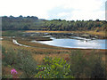
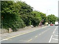
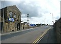
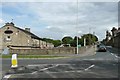
Photos of BD6 3WG
Area Information
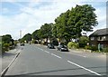
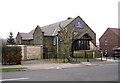
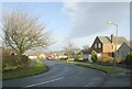
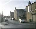
Living in BD6 3WG means being part of a tightly knit residential cluster in Queensbury, a village north of Halifax in West Yorkshire. The area spans 4,241 square metres and is home to 2,168 people, creating a high population density of 511,217 per square kilometre. This small postcode area lies on the historic Bradford-Halifax turnpike road, a route established in 1740 that once connected coaching inns and mills. Today, it retains a quiet, village-like character with a focus on houses rather than high-density development. The proximity to Boothtown and Halifax offers easy access to larger towns, while the area’s compact size fosters a sense of familiarity. Queensbury’s history as a trading hub is reflected in its conservation area, which includes 19th-century buildings like Holy Trinity Church and Black Dyke Mills. For those seeking a balance between rural charm and urban convenience, BD6 3WG offers a distinctive blend of heritage and practicality.
- Area Type
- Postcode
- Area Size
- 4241 m²
- Population
- 2168
- Population Density
- 4984 people/km²
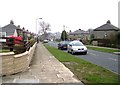
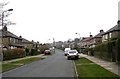
BD6 3WG is primarily an owner-occupied area, with 65% of residents living in their own homes. The accommodation type is predominantly houses, which is unusual for a small postcode area but aligns with the village’s historical development as a residential hub. This suggests a limited supply of rental properties, making the market more attractive to buyers seeking long-term stability. The concentration of houses, rather than apartments or terraced housing, indicates a preference for private, spacious living. However, the small size of the area means the housing stock is finite, and buyers should consider the proximity to nearby towns like Halifax for additional options. The mix of historic and modern homes reflects Queensbury’s evolution from a turnpike road settlement to a contemporary residential community.
House Prices in BD6 3WG
Showing 10 properties
| Address | Type | Beds | Baths | Last Sale Price | Last Sale Date | |
|---|---|---|---|---|---|---|
| 3 Widdop Close, Bradford, BD6 3WG | Detached | 4 | 2 | £270,000 | Nov 2023 | |
| 10 Widdop Close, Bradford, BD6 3WG | Terraced | 3 | 3 | £159,995 | Sep 2023 | |
| 4 Widdop Close, Bradford, BD6 3WG | house | - | - | £100,000 | Mar 2023 | |
| 2 Widdop Close, Bradford, BD6 3WG | house | 4 | 2 | £271,000 | May 2022 | |
| 12 Widdop Close, Bradford, BD6 3WG | house | 3 | 3 | £175,000 | Apr 2022 | |
| 7 Widdop Close, Bradford, BD6 3WG | house | - | - | £165,000 | Sep 2013 | |
| 6 Widdop Close, Bradford, BD6 3WG | Terraced | 3 | 3 | £114,000 | Mar 2013 | |
| 5 Widdop Close, Bradford, BD6 3WG | house | - | - | £225,000 | Jul 2008 | |
| 8 Widdop Close, Bradford, BD6 3WG | house | - | - | £159,995 | Jun 2005 | |
| 1 Widdop Close, Bradford, BD6 3WG | Detached | 3 | - | £247,995 | May 2005 |
Energy Efficiency in BD6 3WG
Residents of BD6 3WG have access to essential retail amenities within walking distance, including Heron Clayton, Aldi Clayton, and Lidl Shelf. These stores provide convenience for everyday shopping, while the nearby railway stations offer connections to broader retail and leisure opportunities in Bradford and Halifax. The area’s compact size means amenities are tightly clustered, reducing the need for long commutes. Though parks and green spaces are not explicitly detailed, the village’s conservation area status suggests pockets of historical and natural interest. The mix of local shops and transport links creates a practical, self-contained lifestyle, ideal for those valuing accessibility without sacrificing the quiet charm of a small village.
Amenities
Schools
Residents of BD6 3WG have access to a range of primary and special schools, including Cooper Lane Primary School, Westwood Park Primary School, Mandale Middle School, and High Trees School, which specialises in supporting students with specific needs. Home Farm Primary School holds an Ofsted rating of ‘good’, offering a reliable educational option for families. The presence of both primary and special schools ensures coverage for children of all ages, though secondary education may require travel to nearby towns. This mix caters to diverse family needs, from early years education to tailored support for students with additional requirements. The proximity of multiple schools within practical reach enhances the area’s appeal for households prioritising convenience in schooling.
| Rank | School | Type | Entry gender | Ages |
|---|
Explore more schools in this area
Go to Schools tabDemographics
The population of BD6 3WG is predominantly middle-aged, with a median age of 47 and the most common age range being adults aged 30–64. Home ownership is strong, with 65% of residents living in their own homes, and the majority of properties are houses rather than flats. The predominant ethnic group is White, reflecting the area’s historical roots in the surrounding rural communities. This demographic profile suggests a stable, long-term resident base with a focus on family-oriented living. The absence of specific deprivation data means the area’s socioeconomic challenges are not detailed, but the high home ownership rate and age profile indicate a community prioritising settled, self-sufficient lifestyles.
Household Size
Accommodation Type
Tenure
Ethnic Group
Religion
Household Composition
Age
Household Deprivation
NS-SEC
Explore more demographic insights in this area
Go to Demographics tabPlanning
Planning Constraints
- Flood RiskPremium
- Ramsar Wetland SitesPremium
- Area of Outstanding Natural BeautyPremium
- Protected Nature ReservePremium
- Protected WoodlandPremium