Area Overview for BD22 6DN
Photos of BD22 6DN
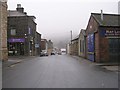
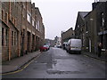
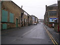
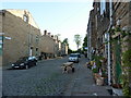
100 photos from this area
Area Information
Key information about the BD22 6DN including its size, population, and administrative classification.
- Area Type
- Postcode
- Area Size
- 4448 m²
- Population
- 1386
- Population Density
- 4109 people/km²
House Prices in BD22 6DN
35
Properties
£81,050
Average Sold Price
£26,000
Lowest Price
£135,000
Highest Price
Showing 35 properties
| Address | Type | Beds | Baths | Last Sale Price | Last Sale Date | |
|---|---|---|---|---|---|---|
| 140 Fell Lane, Keighley, BD22 6DN | Terraced | 3 | 2 | £132,000 | Mar 2025 | |
| 136 Fell Lane, Keighley, BD22 6DN | Terraced | 3 | - | £135,000 | Jan 2024 | |
| 148 Fell Lane, Keighley, BD22 6DN | house | - | - | £122,500 | Dec 2022 | |
| 150 Fell Lane, Keighley, BD22 6DN | Terraced | 3 | 1 | £115,000 | Feb 2022 | |
| 108 Fell Lane, Keighley, BD22 6DN | house | - | - | £65,000 | Oct 2021 | |
| 154 Fell Lane, Keighley, BD22 6DN | house | 4 | - | £119,500 | May 2021 | |
| 126 Fell Lane, Keighley, BD22 6DN | house | - | - | £118,000 | May 2021 | |
| 168 Fell Lane, Keighley, BD22 6DN | house | - | - | £85,000 | Oct 2020 | |
| 166 Fell Lane, Keighley, BD22 6DN | Terraced | 3 | 1 | £65,000 | Apr 2020 | |
| 122 Fell Lane, Keighley, BD22 6DN | Terraced | 2 | 1 | £81,000 | Jun 2019 |
Page 1 of 4
Energy Efficiency in BD22 6DN
Amenities
Schools
| Rank | School | Type | Entry gender | Ages |
|---|
Explore more schools in this area
Go to Schools tabDemographics
Household Size
One person
most common
Accommodation Type
Houses
most common
Tenure
47
majority
Ethnic Group
White
most common
Religion
N/A
most common
Household Composition
N/A
most common
Age
47
median
Adults (30-64 years)
most common
Household Deprivation
N/A
with no deprivation
NS-SEC
18
in Lower managerial occupations
Explore more demographic insights in this area
Go to Demographics tabPlanning
Planning Constraints
- Flood RiskPremium
- Ramsar Wetland SitesPremium
- Area of Outstanding Natural BeautyPremium
- Protected Nature ReservePremium
- Protected WoodlandPremium