Area Overview for WV5 0JX
Photos of WV5 0JX
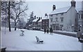
100 photos from this area
Area Information
Key information about the WV5 0JX including its size, population, and administrative classification.
- Area Type
- Postcode
- Area Size
- 1.1 hectares
- Population
- 1457
- Population Density
- 3899 people/km²
House Prices in WV5 0JX
24
Properties
£208,044
Average Sold Price
£98,000
Lowest Price
£389,950
Highest Price
Showing 24 properties
| Address | Type | Beds | Baths | Last Sale Price | Last Sale Date | |
|---|---|---|---|---|---|---|
| 23 Cedars Avenue, Wombourne, WV5 0JX | house | 3 | 1 | £389,950 | Jan 2024 | |
| 11 Cedars Avenue, Wombourne, WV5 0JX | house | - | - | £320,000 | Oct 2022 | |
| 14 Cedars Avenue, Wombourne, WV5 0JX | house | - | - | £309,950 | Aug 2022 | |
| 19 Cedars Avenue, Wombourne, WV5 0JX | Detached | 3 | - | £211,500 | Sep 2013 | |
| 17 Cedars Avenue, Wombourne, WV5 0JX | house | - | - | £210,000 | Sep 2010 | |
| 20 Cedars Avenue, Wombourne, WV5 0JX | house | 3 | - | £129,000 | Sep 2001 | |
| 13 Cedars Avenue, Wombourne, WV5 0JX | Detached | - | - | £105,000 | Aug 2000 | |
| 21 Cedars Avenue, Wombourne, WV5 0JX | Detached | - | - | £98,000 | May 1999 | |
| 12 Cedars Avenue, Wombourne, WV5 0JX | Detached | 4 | - | £99,000 | Oct 1998 | |
| 27 Cedars Avenue, Wombourne, WV5 0JX | house | - | - | - | - |
Page 1 of 3
Energy Efficiency in WV5 0JX
Amenities
Schools
| Rank | School | Type | Entry gender | Ages |
|---|
Explore more schools in this area
Go to Schools tabDemographics
Household Size
Two person
most common
Accommodation Type
Houses
most common
Tenure
86
majority
Ethnic Group
White
most common
Religion
N/A
most common
Household Composition
N/A
most common
Age
47
median
Adults (30-64 years)
most common
Household Deprivation
N/A
with no deprivation
NS-SEC
40
in Lower managerial occupations
Explore more demographic insights in this area
Go to Demographics tabPlanning
Planning Constraints
- Flood RiskPremium
- Ramsar Wetland SitesPremium
- Area of Outstanding Natural BeautyPremium
- Protected Nature ReservePremium
- Protected WoodlandPremium