Area Overview for WV5 0HP
Photos of WV5 0HP
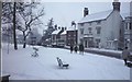
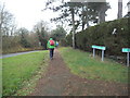
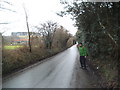
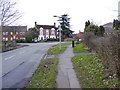
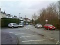
100 photos from this area
Area Information
Key information about the WV5 0HP including its size, population, and administrative classification.
- Area Type
- Postcode
- Area Size
- 1.3 hectares
- Population
- 1457
- Population Density
- 3899 people/km²
House Prices in WV5 0HP
21
Properties
£182,214
Average Sold Price
£71,500
Lowest Price
£320,000
Highest Price
Showing 21 properties
| Address | Type | Beds | Baths | Last Sale Price | Last Sale Date | |
|---|---|---|---|---|---|---|
| 3 Greenfields Road, Wombourne, WV5 0HP | Bungalow | 3 | 2 | £320,000 | Aug 2024 | |
| 13 Greenfields Road, Wombourne, WV5 0HP | house | - | - | £250,000 | Mar 2024 | |
| 18 Greenfields Road, Wombourne, WV5 0HP | house | - | - | £290,000 | Dec 2021 | |
| 12 Greenfields Road, Wombourne, WV5 0HP | Bungalow | - | - | £190,000 | Feb 2016 | |
| 4 Greenfields Road, Wombourne, WV5 0HP | Semi-detached | 2 | 1 | £141,500 | Dec 2014 | |
| 20 Greenfields Road, Wombourne, WV5 0HP | Bungalow | - | - | £172,000 | Nov 2012 | |
| 9 Greenfields Road, Wombourne, WV5 0HP | Bungalow | 3 | - | £179,000 | May 2012 | |
| 15 Greenfields Road, Wombourne, WV5 0HP | Semi-detached | 2 | 2 | £165,000 | May 2011 | |
| 8 Greenfields Road, Wombourne, WV5 0HP | house | - | - | £162,500 | May 2010 | |
| 21 Greenfields Road, Wombourne, WV5 0HP | Semi-detached | - | - | £230,000 | Apr 2008 |
Page 1 of 3
Energy Efficiency in WV5 0HP
Amenities
Schools
| Rank | School | Type | Entry gender | Ages |
|---|
Explore more schools in this area
Go to Schools tabDemographics
Household Size
Two person
most common
Accommodation Type
Houses
most common
Tenure
86
majority
Ethnic Group
White
most common
Religion
N/A
most common
Household Composition
N/A
most common
Age
47
median
Adults (30-64 years)
most common
Household Deprivation
N/A
with no deprivation
NS-SEC
40
in Lower managerial occupations
Explore more demographic insights in this area
Go to Demographics tabPlanning
Planning Constraints
- Flood RiskPremium
- Ramsar Wetland SitesPremium
- Area of Outstanding Natural BeautyPremium
- Protected Nature ReservePremium
- Protected WoodlandPremium