Area Overview for WV12 5YL
Photos of WV12 5YL
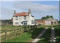
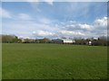
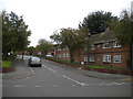
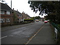
14 photos from this area
Area Information
Key information about the WV12 5YL including its size, population, and administrative classification.
- Area Type
- Postcode
- Area Size
- 1.9 hectares
- Population
- 1427
- Population Density
- 4465 people/km²
House Prices in WV12 5YL
53
Properties
£117,810
Average Sold Price
£4,100
Lowest Price
£380,000
Highest Price
Showing 53 properties
| Address | Type | Beds | Baths | Last Sale Price | Last Sale Date | |
|---|---|---|---|---|---|---|
| 31 Redwood Way, Wolverhampton, WV12 5YL | Semi-detached | 3 | 1 | £255,000 | May 2023 | |
| 14 Redwood Way, Willenhall, WV12 5YL | Maisonette | 1 | 1 | £80,000 | Apr 2023 | |
| 18A Redwood Way, Wolverhampton, WV12 5YL | house | - | - | £380,000 | Nov 2022 | |
| 2 Redwood Way, Willenhall, WV12 5YL | Flat | 1 | - | £95,000 | Jan 2022 | |
| 62 Redwood Way, Wolverhampton, WV12 5YL | Semi-detached | 2 | 1 | £168,500 | Sep 2021 | |
| 37 Redwood Way, Wolverhampton, WV12 5YL | Semi-detached | 3 | 2 | £158,000 | Nov 2018 | |
| 5 Redwood Way, Willenhall, WV12 5YL | Semi-detached | - | - | £4,100 | Dec 2017 | |
| 41 Redwood Way, Wolverhampton, WV12 5YL | Semi-detached | 4 | - | £161,500 | Apr 2017 | |
| 17 Redwood Way, Wolverhampton, WV12 5YL | Semi-detached | - | - | £5,650 | Sep 2016 | |
| 52 Redwood Way, Wolverhampton, WV12 5YL | Detached | 3 | 1 | £194,950 | Aug 2016 |
Page 1 of 6
Energy Efficiency in WV12 5YL
Amenities
Schools
| Rank | School | Type | Entry gender | Ages |
|---|
Explore more schools in this area
Go to Schools tabDemographics
Household Size
Family (3-5 people)
most common
Accommodation Type
Houses
most common
Tenure
67
majority
Ethnic Group
White
most common
Religion
N/A
most common
Household Composition
N/A
most common
Age
47
median
Adults (30-64 years)
most common
Household Deprivation
N/A
with no deprivation
NS-SEC
24
in Lower managerial occupations
Explore more demographic insights in this area
Go to Demographics tabPlanning
Planning Constraints
- Flood RiskPremium
- Ramsar Wetland SitesPremium
- Area of Outstanding Natural BeautyPremium
- Protected Nature ReservePremium
- Protected WoodlandPremium