Area Overview for WV10 6BU
Photos of WV10 6BU

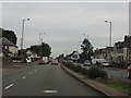

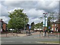

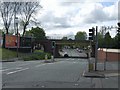
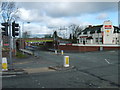

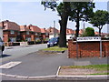


88 photos from this area
Area Information
Key information about the WV10 6BU including its size, population, and administrative classification.
- Area Type
- Postcode
- Area Size
- 1.7 hectares
- Population
- 1765
- Population Density
- 5297 people/km²
House Prices in WV10 6BU
54
Properties
£98,625
Average Sold Price
£30,000
Lowest Price
£215,000
Highest Price
Showing 54 properties
| Address | Type | Beds | Baths | Last Sale Price | Last Sale Date | |
|---|---|---|---|---|---|---|
| 59 Crathorne Avenue, Wolverhampton, WV10 6BU | house | 3 | 1 | £160,000 | Mar 2025 | |
| 52 Crathorne Avenue, Wolverhampton, WV10 6BU | Semi-detached | 3 | 1 | £204,000 | Mar 2025 | |
| 48 Crathorne Avenue, Wolverhampton, WV10 6BU | Semi-detached | 3 | 1 | £215,000 | Feb 2025 | |
| 91 Crathorne Avenue, Wolverhampton, WV10 6BU | Semi-detached | 3 | 1 | £197,000 | Dec 2022 | |
| 47 Crathorne Avenue, Wolverhampton, WV10 6BU | house | - | - | £85,000 | Jul 2021 | |
| 76 Crathorne Avenue, Wolverhampton, WV10 6BU | Semi-detached | 3 | 1 | £165,000 | Jul 2021 | |
| 70 Crathorne Avenue, Wolverhampton, WV10 6BU | Semi-detached | 3 | 1 | £110,000 | Apr 2021 | |
| 54 Crathorne Avenue, Wolverhampton, WV10 6BU | Semi-detached | 3 | 1 | £136,000 | Mar 2021 | |
| 84 Crathorne Avenue, Wolverhampton, WV10 6BU | house | - | - | £130,000 | Nov 2020 | |
| 95 Crathorne Avenue, Wolverhampton, WV10 6BU | house | - | - | £105,500 | Nov 2019 |
Page 1 of 6
Energy Efficiency in WV10 6BU
Amenities
Schools
| Rank | School | Type | Entry gender | Ages |
|---|
Explore more schools in this area
Go to Schools tabDemographics
Household Size
Family (3-5 people)
most common
Accommodation Type
Houses
most common
Tenure
61
majority
Ethnic Group
White
most common
Religion
N/A
most common
Household Composition
N/A
most common
Age
47
median
Adults (30-64 years)
most common
Household Deprivation
N/A
with no deprivation
NS-SEC
19
in Lower managerial occupations
Explore more demographic insights in this area
Go to Demographics tabPlanning
Planning Constraints
- Flood RiskPremium
- Ramsar Wetland SitesPremium
- Area of Outstanding Natural BeautyPremium
- Protected Nature ReservePremium
- Protected WoodlandPremium