Area Overview for WV10 6AL
Photos of WV10 6AL

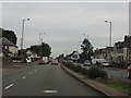
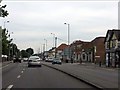
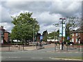
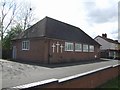
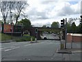
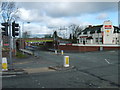

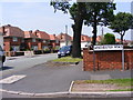
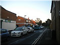
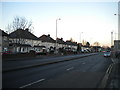
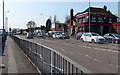
88 photos from this area
Area Information
Key information about the WV10 6AL including its size, population, and administrative classification.
- Area Type
- Postcode
- Area Size
- 1.2 hectares
- Population
- 2289
- Population Density
- 3738 people/km²
House Prices in WV10 6AL
26
Properties
£107,179
Average Sold Price
£47,500
Lowest Price
£226,000
Highest Price
Showing 26 properties
| Address | Type | Beds | Baths | Last Sale Price | Last Sale Date | |
|---|---|---|---|---|---|---|
| 442 Stafford Road, Wolverhampton, WV10 6AL | Semi-detached | 3 | 1 | £226,000 | Jul 2023 | |
| 438 Stafford Road, Wolverhampton, WV10 6AL | house | - | - | £114,287 | Sep 2021 | |
| 416 Stafford Road, Wolverhampton, WV10 6AL | Bungalow | 3 | 1 | £107,000 | Jul 2017 | |
| 426 Stafford Road, Wolverhampton, WV10 6AL | Semi-detached | 3 | - | £123,000 | Jan 2017 | |
| 440 Stafford Road, Wolverhampton, WV10 6AL | Semi-detached | 3 | 2 | £100,000 | Jan 2016 | |
| 444 Stafford Road, Wolverhampton, WV10 6AL | Semi-detached | 3 | 1 | £82,000 | Jul 2011 | |
| 446 Stafford Road, Wolverhampton, WV10 6AL | Terraced | 3 | 1 | £85,000 | Dec 2005 | |
| 432 Stafford Road, Wolverhampton, WV10 6AL | Semi-detached | - | - | £123,500 | Oct 2005 | |
| 430 Stafford Road, Wolverhampton, WV10 6AL | Semi-detached | - | - | £63,500 | Dec 2001 | |
| 420 Stafford Road, Wolverhampton, WV10 6AL | Semi-detached | - | - | £47,500 | Jul 1998 |
Page 1 of 3
Energy Efficiency in WV10 6AL
Amenities
Schools
| Rank | School | Type | Entry gender | Ages |
|---|
Explore more schools in this area
Go to Schools tabDemographics
Household Size
Family (3-5 people)
most common
Accommodation Type
Houses
most common
Tenure
76
majority
Ethnic Group
White
most common
Religion
N/A
most common
Household Composition
N/A
most common
Age
47
median
Adults (30-64 years)
most common
Household Deprivation
N/A
with no deprivation
NS-SEC
36
in Lower managerial occupations
Explore more demographic insights in this area
Go to Demographics tabPlanning
Planning Constraints
- Flood RiskPremium
- Ramsar Wetland SitesPremium
- Area of Outstanding Natural BeautyPremium
- Protected Nature ReservePremium
- Protected WoodlandPremium