Area Overview for WS9 8HW
Photos of WS9 8HW
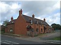
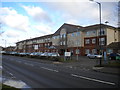
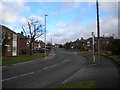
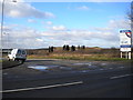
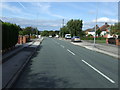
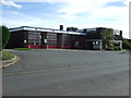
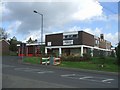
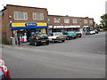
15 photos from this area
Area Information
Key information about the WS9 8HW including its size, population, and administrative classification.
- Area Type
- Postcode
- Area Size
- 2.2 hectares
- Population
- 1638
- Population Density
- 5842 people/km²
House Prices in WS9 8HW
50
Properties
£131,655
Average Sold Price
£23,000
Lowest Price
£230,000
Highest Price
Showing 50 properties
| Address | Type | Beds | Baths | Last Sale Price | Last Sale Date | |
|---|---|---|---|---|---|---|
| 48 Jessie Road, Aldridge, WS9 8HW | house | - | - | £192,500 | Jun 2023 | |
| 40 Jessie Road, Aldridge, WS9 8HW | Terraced | - | - | £185,000 | Jan 2023 | |
| 1 Jessie Road, Aldridge, WS9 8HW | house | - | - | £230,000 | Nov 2022 | |
| 44 Jessie Road, Aldridge, WS9 8HW | house | - | - | £187,000 | Aug 2021 | |
| 8 Jessie Road, Aldridge, WS9 8HW | house | - | - | £145,000 | May 2019 | |
| 47 Jessie Road, Aldridge, WS9 8HW | house | - | - | £81,000 | Mar 2019 | |
| 9 Jessie Road, Aldridge, WS9 8HW | Semi-detached | 4 | 1 | £225,000 | Dec 2018 | |
| 19 Jessie Road, Aldridge, WS9 8HW | house | - | - | £120,000 | Nov 2017 | |
| 14 Jessie Road, Aldridge, WS9 8HW | house | - | - | £142,000 | Aug 2017 | |
| 32 Jessie Road, Aldridge, WS9 8HW | house | 3 | - | £133,500 | Aug 2012 |
Page 1 of 5
Energy Efficiency in WS9 8HW
Amenities
Schools
| Rank | School | Type | Entry gender | Ages |
|---|
Explore more schools in this area
Go to Schools tabDemographics
Household Size
One person
most common
Accommodation Type
Houses
most common
Tenure
52
majority
Ethnic Group
White
most common
Religion
N/A
most common
Household Composition
N/A
most common
Age
47
median
Adults (30-64 years)
most common
Household Deprivation
N/A
with no deprivation
NS-SEC
22
in Lower managerial occupations
Explore more demographic insights in this area
Go to Demographics tabPlanning
Planning Constraints
- Flood RiskPremium
- Ramsar Wetland SitesPremium
- Area of Outstanding Natural BeautyPremium
- Protected Nature ReservePremium
- Protected WoodlandPremium