Area Overview for WS7 0LQ
Photos of WS7 0LQ

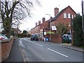
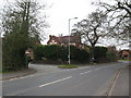
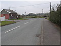
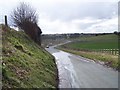
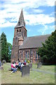
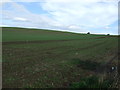


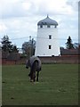
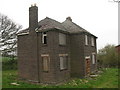
16 photos from this area
Area Information
Key information about the WS7 0LQ including its size, population, and administrative classification.
- Area Type
- Postcode
- Area Size
- 23.3 hectares
- Population
- 1582
- Population Density
- 183 people/km²
House Prices in WS7 0LQ
43
Properties
£271,414
Average Sold Price
£56,750
Lowest Price
£650,000
Highest Price
Showing 43 properties
| Address | Type | Beds | Baths | Last Sale Price | Last Sale Date | |
|---|---|---|---|---|---|---|
| 25 Overton Lane, Hammerwich, Burntwood, WS7 0LQ | Detached | 4 | 2 | £402,000 | Jul 2025 | |
| 29 Overton Lane, Hammerwich, Burntwood, WS7 0LQ | Semi-detached | 2 | 2 | £360,000 | Feb 2025 | |
| 79 Overton Lane, Hammerwich, Burntwood, WS7 0LQ | Detached | 4 | 2 | £650,000 | Jul 2024 | |
| 17 Overton Lane, Hammerwich, Burntwood, WS7 0LQ | Semi-detached | 4 | 2 | £366,250 | Jan 2024 | |
| 15 Overton Lane, Hammerwich, Burntwood, WS7 0LQ | Semi-detached | 3 | 1 | £297,000 | Nov 2023 | |
| 43 Overton Lane, Hammerwich, Burntwood, WS7 0LQ | Semi-detached | 4 | 1 | £317,000 | Nov 2023 | |
| Half Acre, Overton Lane, Hammerwich, Burntwood, WS7 0LQ | Bungalow | 3 | 2 | £430,000 | Apr 2023 | |
| 13 Overton Lane, Hammerwich, Burntwood, WS7 0LQ | house | - | - | £265,100 | Oct 2022 | |
| 67 Overton Lane, Hammerwich, Burntwood, WS7 0LQ | Semi-detached | 3 | 1 | £230,000 | Aug 2020 | |
| 39 Overton Lane, Hammerwich, Burntwood, WS7 0LQ | Semi-detached | 3 | 1 | £263,000 | Feb 2020 |
Page 1 of 5
Energy Efficiency in WS7 0LQ
Amenities
Schools
| Rank | School | Type | Entry gender | Ages |
|---|
Explore more schools in this area
Go to Schools tabDemographics
Household Size
Two person
most common
Accommodation Type
Houses
most common
Tenure
83
majority
Ethnic Group
White
most common
Religion
N/A
most common
Household Composition
N/A
most common
Age
47
median
Adults (30-64 years)
most common
Household Deprivation
N/A
with no deprivation
NS-SEC
40
in Lower managerial occupations
Explore more demographic insights in this area
Go to Demographics tabPlanning
Planning Constraints
- Flood RiskPremium
- Ramsar Wetland SitesPremium
- Area of Outstanding Natural BeautyPremium
- Protected Nature ReservePremium
- Protected WoodlandPremium